|
0 members (),
40
guests, and
29
robots. |
|
Key:
Admin,
Global Mod,
Mod
|
|
 Whitney via the scenic route 9/15-9/17
|
Joined: Jul 2015
Posts: 58
|
OP

Joined: Jul 2015
Posts: 58 |
This past year the lions share of my vacation time was used up on a car camping trip with my family hitting Lassen and Crater Lake National Parks over the 4th of July and spending a week with my son’s Boy Scout Troop at summer camp as an ASM. Using up all my vacation time ruled out any grand week long backpacking trips this year.
In September of 2016 I had planned on hiking from Shepherds Pass and summiting Tyndall, Williamson, Trojan Peak, Barnard, Russell, Whitney, and Muir all in one shot over a period of 5 days, mostly off trail. I lined up the time off and found a hiking partner that was interested. Well, when planning grand adventure such as that one must be sure of your hiking partners abilities. The first night after starting late at the Shepherds Pass trailhead and stopping at Mahogany Flat for the night my hiking partner had decided he had bitten off more than he could chew. I rolled with it, we changed up our plans and still had a good time and summited Tyndall.
Whitney was still on my to do list so I got a hold of a friend that I had hiked White Mountain Peak with a couple of years ago to see if he was game to fit a trip in between a couple of other trips he had on the books for September. I laid out my plan for him and he was interested as the route went through some areas he wanted to check out as well. I scheduled a three day trip starting on the 15th of September and proceeded to get things ready.
On Thursday the 14th I worked a half day and left my office just south of Downtown LA around 12:30 to head up to Lone Pine and secure a walk-in permit before they closed for the day. The drive to Lone Pine from LA was uneventful and I made decent time arriving at the Eastern Sierra Interagency Visitor Center about 3:45. Went up to the permit desk, explained my route and walked out a few minutes later with a permit for my trip.
I had a little time to kill as my hiking partner Jose wasn't due to arrive until around 7:30 so I sat in the parking lot for a while trying to figure out why my Suunto Ambit 3 had decided to go blank and give up the ghost on the drive up. Not making any headway on that front I left the visitor center and drove to the gas station to fill up my truck so I wouldn't have to worry about it after we were done with our trip. I still had some time to kill so I grabbed a bite to eat and then headed up to the Portal to look around the store, chat with Doug Jr, and wander around until Jose arrived. At 7:00 I got a message from Jose on my inreach that he was in Lone Pine and was making his way up the hill and should be there around 7:30. About 7:40 Jose arrived, we parked his truck and transferred his gear to my truck. The drive from the Portal to Horseshoe Meadows was uneventful and we arrived just before 9:00. We parked at the trailhead lot and from initial observations things looked pretty full. We lucked out and managed to find an unoccupied site at the back of the Cottonwood Lakes walk-in campground. We set up our sleeping arrangements and hung out around the campfire until about 11 when we both decided to douse the fire and call it a night.
|
|
|
 Re: Whitney via the scenic route 9/15-9/17
|
Joined: Jul 2015
Posts: 58
|
OP

Joined: Jul 2015
Posts: 58 |
On Friday the 15th we woke up to a brisk morning. We lazily made coffee, ate some breakfast and proceeded to pack up our stuff and got ready to hit the trail. With a quick stop to stow any unnecessary items in my truck and use the facilities we were on our way up the trail towards Cottonwood Lakes at 8:00. The section of trail between Horseshoe Meadows and the beginning of Cottonwood Lakes went surprisingly quick. We were greeted with the expanse of Cottonwood Lakes, Mount Langley and Cirque Peak as we crested the hill. We took a breather here and ate some snacks and took some photos before we began again. We made a beeline through the basin towards lakes 3, 4, and 5 passing the familiar sight of the tin cladded cabin on the edge of the unnamed tarn before lake 3. The section of trail between there and our next objective passed quickly and we soon found ourselves at the beginning of the climb to Old Army Pass. Cottonwood Lakes Trailhead 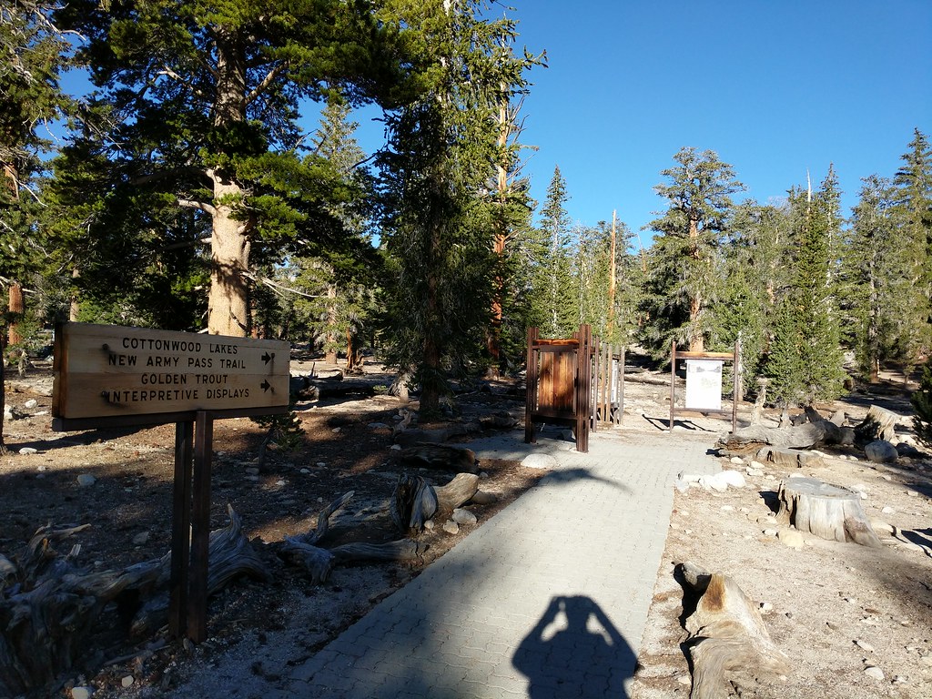 Jose crossing the stream just after the John Muir Wilderness boundary 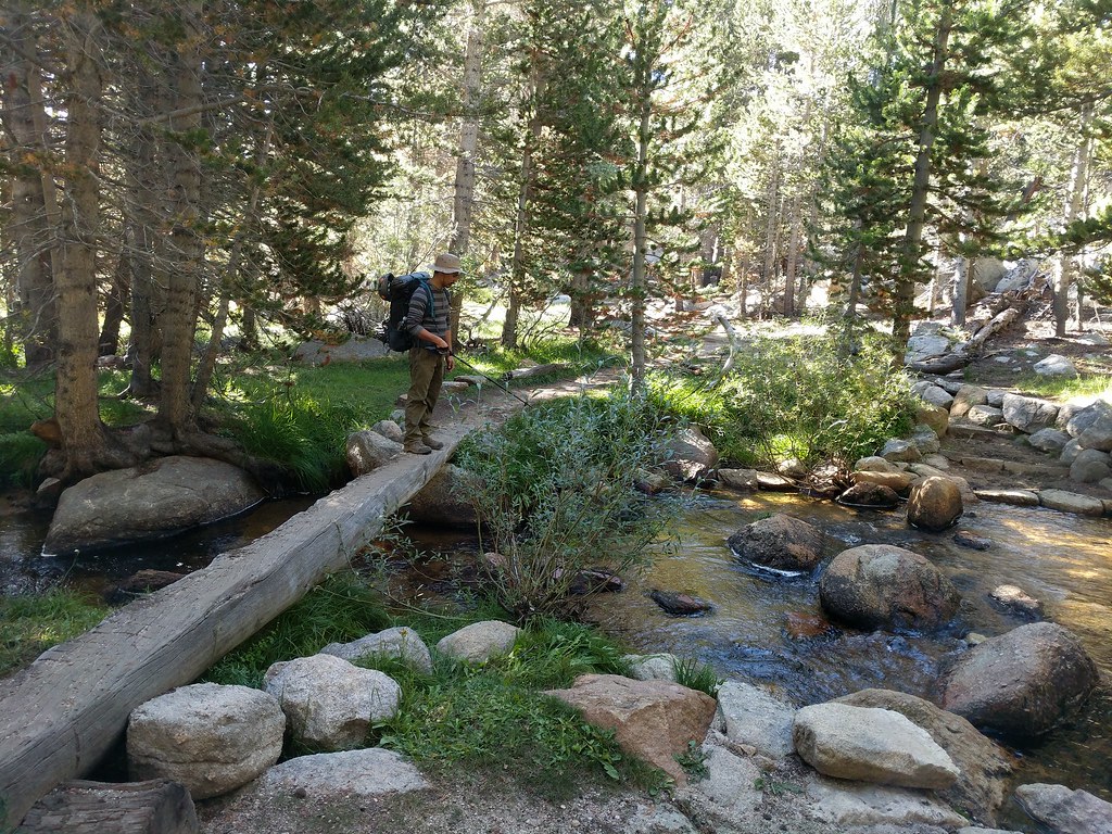 Pano from the start of the Cottonwood Lakes Basin  Cabin next to the tarn with Langley looming in the distance 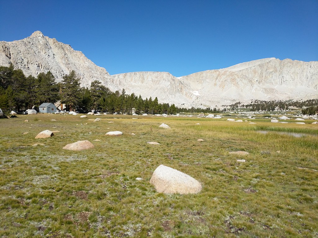 Looking up to Old Army Pass from the far end of Lake 4  Old Army Pass was in great shape with only a small patch of snow to cross early in the climb. We were both surprised how quickly that we made the trek to the top of the pass. We both agreed that we must be in better shape than the last time we each had individually climbed Old Army Pass as it only took us 45 minutes to make it to the top. From the top of Old Army Pass we saw quite a few day hikers heading up to summit Mount Langley. We both had summited Langley in the past so it wasn't on the radar for this trip. We quickly headed downhill on the trail, passing the junction that leads up to New Army Pass and descending towards Rock Creek and Lower Soldier Lake. Just before the turnoff to Lower Soldier Lake we found a nice flat area to stop for lunch. By this time it was 1:00 and we were making good progress towards our final goal for the day. After lunch we hiked the short distance to the junction for Lower Soldier Lake and headed north. The original plan was to head around the east side of the lake, then up the notch, and down to Rock Creek. When we arrived at the east side of the lake we were confronted with a wet, marshy bushwhack of a trail through the brush on the side of the lake. After going a short way in we decided to circle around the lake and hit the use trail at the northwest corner of the lake that would lead us up the hill and the the ridgeline to the east of Rock Creek. We made the scramble to the top of the hill in a scant 10 minutes and proceeded to travel cross country and stay level on the ridgeline until we could see the use trail that made it's way up along the banks of Rock Creek. When we finally spotted the use trail below we slowly dropped down the ridge and stopped for a quick break on top of some boulders to take pics of the awesome view of the miter basin laid out before us. Looking back down to Cottonwood Lakes from the top of Old Army Pass: 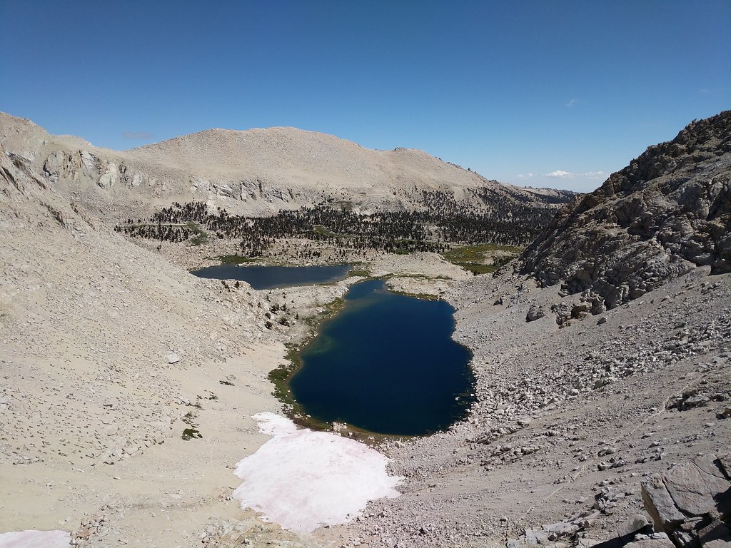 Wildflowers along the stream as we descended from the Army Passes 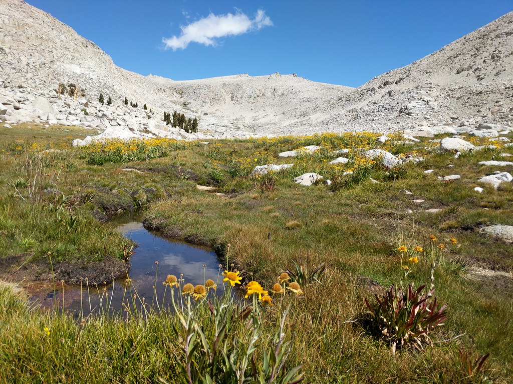 Almost to our lunch stop 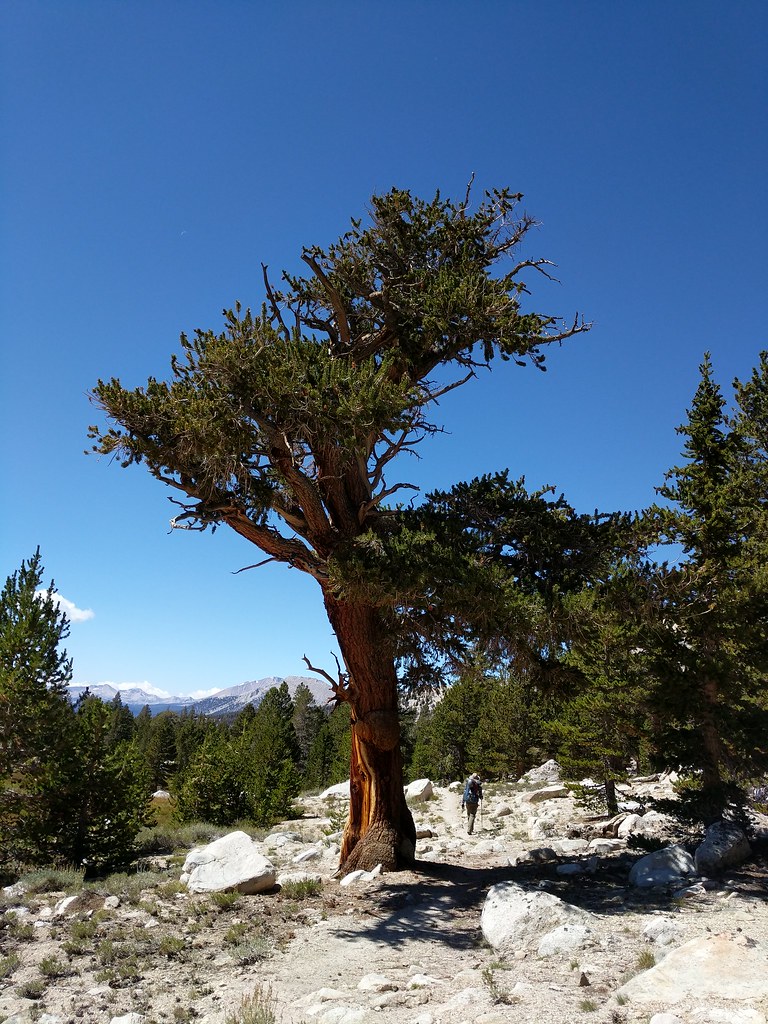 Taking in the vistas as moody clouds draped the landscape in shadows and sun 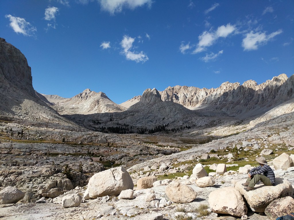 After killing some time taking pics we re-shouldered our packs and made our way to the use trail that winds its way through the basin, with the trail dropping in and out as it snaked it's way along the edge of Rock Creek. We shortly found ourselves facing the last bit of uphill between us and our objective for the day, Sky Blue Lake. We followed the path of least resistance along the slabs and waterfalls that guard the entrance to Sky Blue Lake and found ourselves staring at a wonderful alpine lake nestled amongst stark granite cliffs. A short walk later around the south side of the lake and we found a good spot far enough away from the water that was level and offered some protection from the wind that was blowing over Crabtree Pass and into the basin. It was now 4:30 and the light seemed to be fading quickly so we made quick work of setting up camp and filtering water for dinner. After the camp chores were done we both wandered around and took more pics of the surrounding environs. We had both wanted to explore this area and so far we were really glad we had put forth the effort to make it there. The lake was pretty quiet, with only one other group camped on the opposite side of the lake from us. This was surprising as we had passed no fewer than four other groups on our way there who said that Sky Blue Lake was there final destination for the day. Miter Basin from along Rock Creek 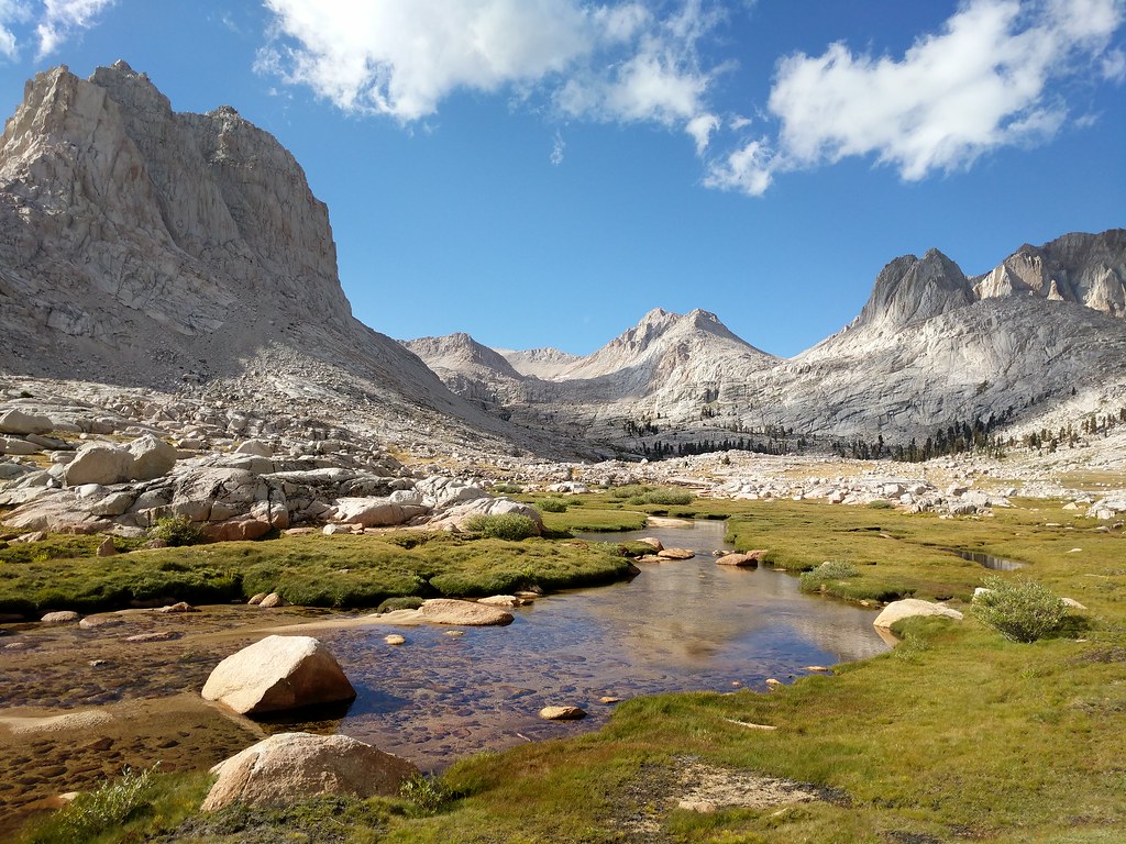 Making our way through the basin to Sky Blue Lake along the spotty use trail 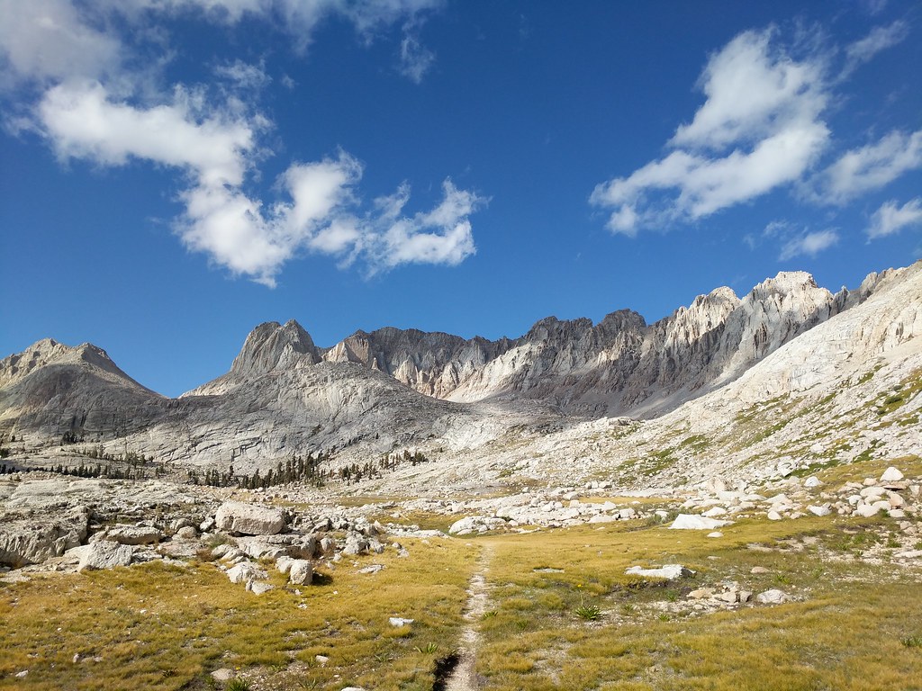 Pano on the shore of Sky Blue Lake from Crabtree Pass in the west to Langley in the east  After many photos were taken we ate dinner and watched the skies darken and the entire basin get plunged into shadow, with the final light of the day illuminating some lingering clouds with dark reds and oranges. With the day drawing to a close and darkness encroaching Jose decided to retire to his tent. As I had only brought my bivy along on this trip I wasn't quite ready to go-to sleep as of yet so I wandered up on the cliff above where were camped to look at the stars in their grandeur. A little while later finally sufficiently wound down after our 14 mile hike in I went back to where we were camped to retire for the evening. While getting situated for bed I glanced up at the cliff and saw a big rock perched right above my head. At this point I decided to walk back up the cliff above and check out this bit of impending doom and make a judgement as to it's stability. After a quick inspection I judged it's stability to be of a questionable nature and descended to relocate my bivy out of the path of this silent lurking threat. With things safely relocated out of harm's way I crawled into my bivy, cinching my sleeping bag around my head and drifting off to sleep with the stars illuminating the sky above. Last light of the day on the shoulder of Mt. McAdie 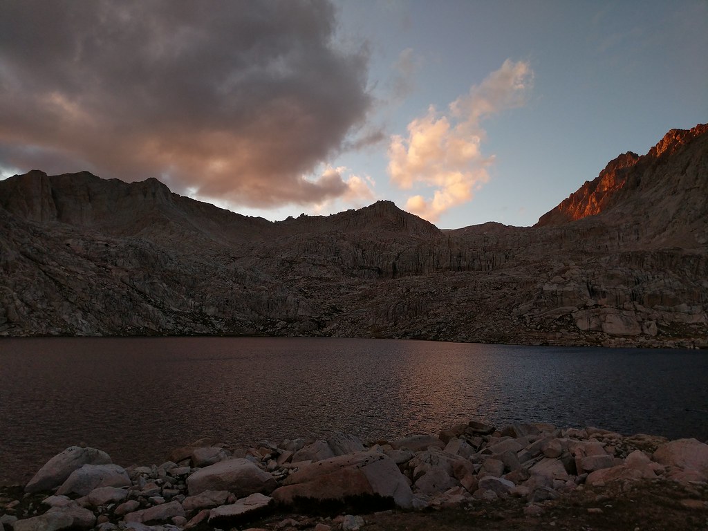 Firey glow in the clouds over Mt. Newcomb 
|
|
|
 Re: Whitney via the scenic route 9/15-9/17
|
Joined: Jul 2015
Posts: 58
|
OP

Joined: Jul 2015
Posts: 58 |
I awoke early on Saturday the 16th to watch the sunrise over Sky Blue Lake and the Miter Basin and found a layer of frost covering most of the gear that we had left out overnight, including our bear cans and the shelters. As the sun began to peek above the horizon the basin was awash with warm morning light and fish began to rise, with a few spectacular jumpers breaking the surface of the water. We brushed off as much frost as possible and for anything that was still frosty or damp we placed it in the path of the rising sun. As everything was drying out a bit we made coffee, ate some breakfast, treated a small volume of water for the hike and proceeded to pack up everything. We began the day by taking the standard route around Sky Blue Lake, north along the eastern shore and then west along the north shore until we reached the inlet stream. On our path around the lake we spotted several nice sized goldens hovering in the water column, just off the shore. At this point I was kicking myself for not bringing a fishing pole of some variety to try and tempt those beauties. It just adds another reason to the list of many to come back and spend more time in the Miter Basin. We followed the inlet stream up the hill, taking the path of least resistance to make it to our next goal. The route finding was pretty straight forward and offered plenty of views of where we had camped the the night before, as well as some of the better displays of Sierra Shooting Star along the stream I have seen. First light pano of the entire shore of Sky Blue Lake and surrounding peaks  Frosty Gear 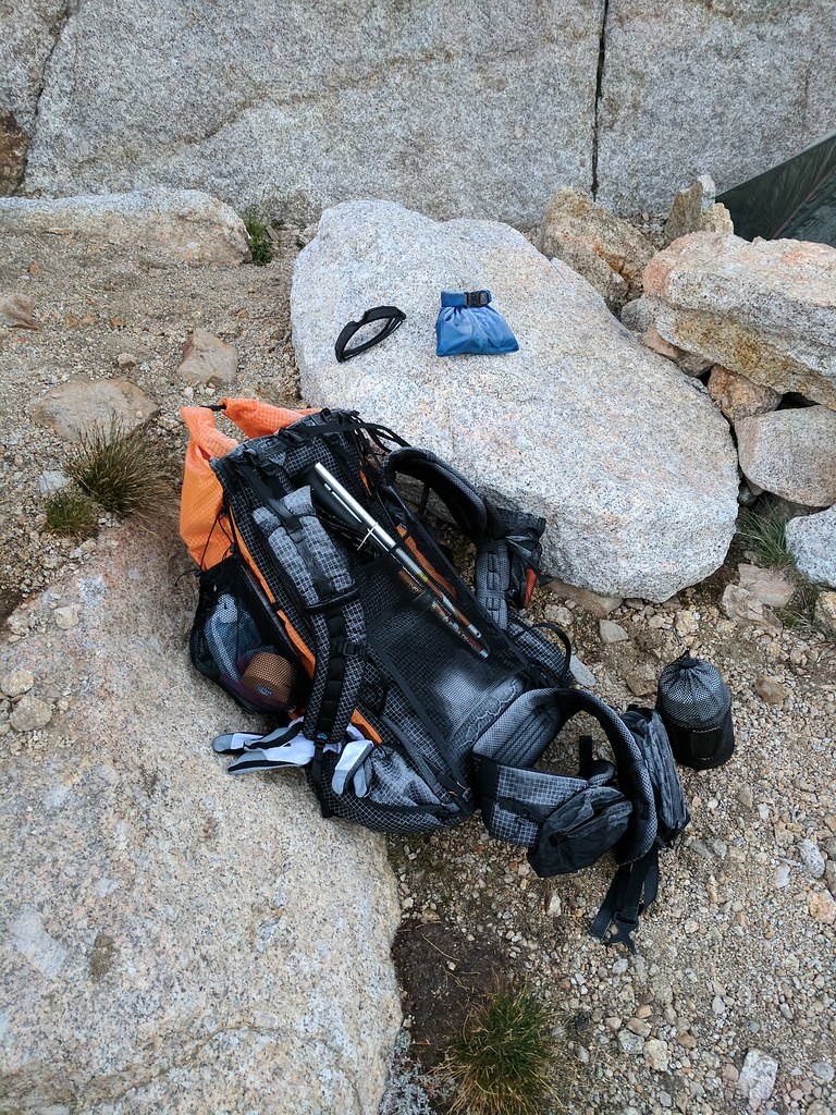 Morning Reflections 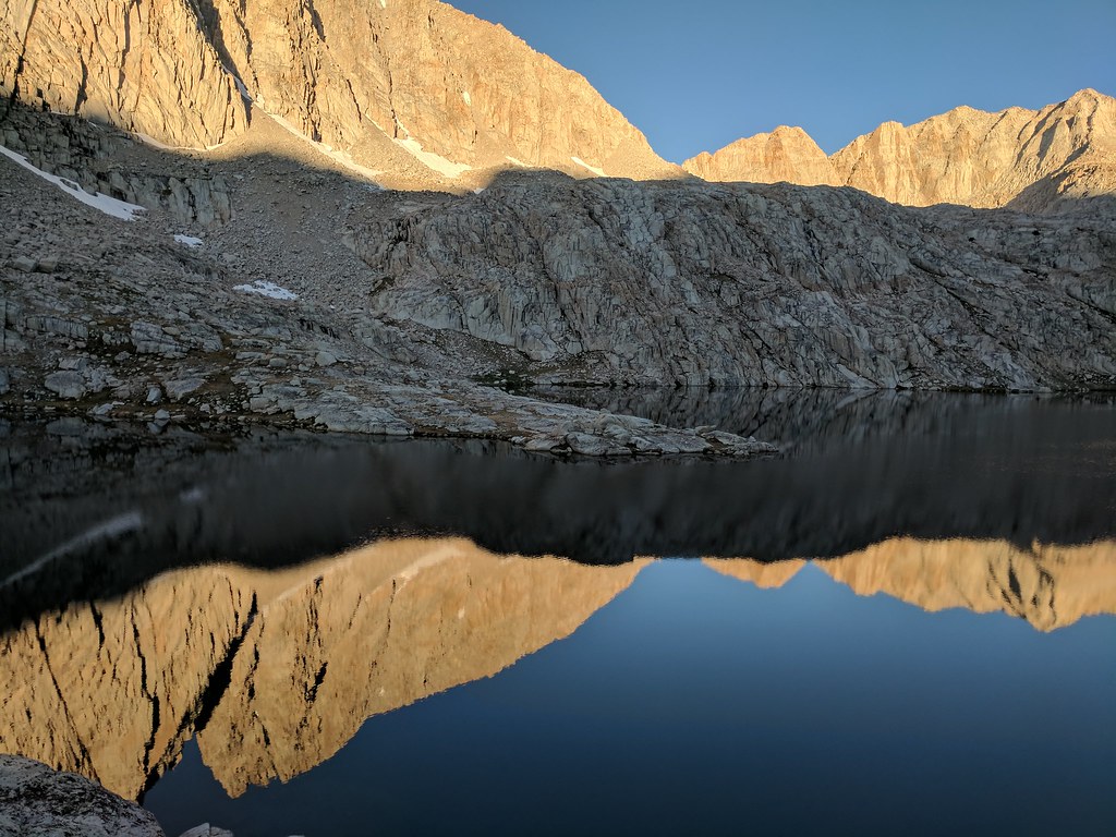 Good sized fish hovering in the water column 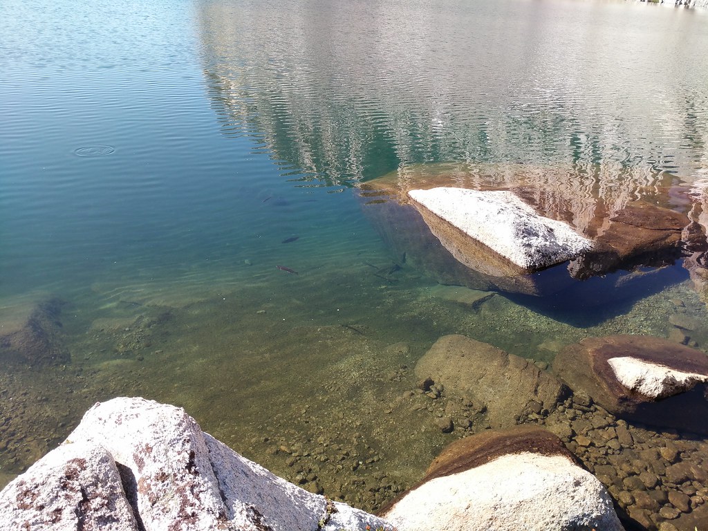 Sierra Shooting Star along the stream 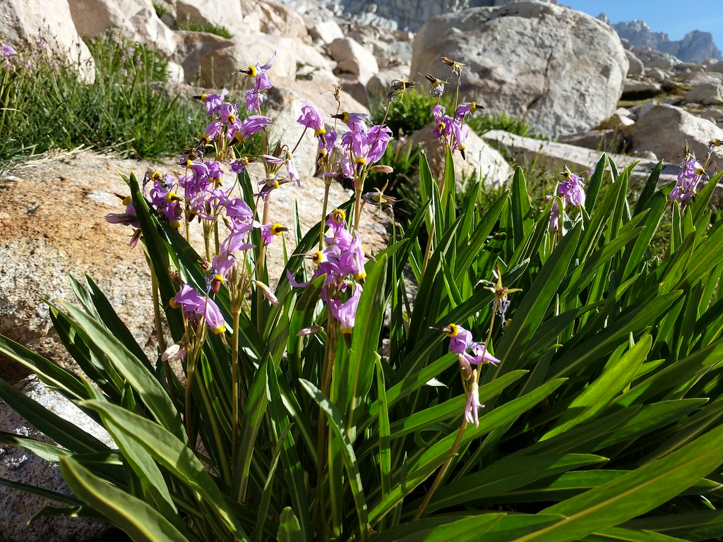 We continued making our way upwards to the next waypoint on our journey which was Lake 12129 (or 3697 depending on which map you consult) Again, the route finding in this section was quite tame. We decided to stay high on the ridgeline and only drop down when necessary. This worked out well, and we soon found ourselves above the notch that serves as the outlet for Lake 12129. At this point we had a decision to make on which route to take - west through the cliffs surrounding the lake or east and follow the use trail we spied across the lake. The route to the east looked mellower so that was the route we chose. We headed across the notch and the outlet stream then went up and to our left on a line we had sighted out before we started. The idea was to stay high and keep it class 2, avoiding the possible class 3-4 downclimb if you stay lower and near the water line. Things went to plan and we made the easy scramble, crossing a small snow patch then picking up the use trail we spied from the other side of the lake. As it was a use trail it petered in and out as it crossed through some larger boulders, but following the path of least resistance it always reappeared and we made quick work of that section. We tanked up on water at the far end of the lake, not knowing which route we were going to take from our next destination, Crabtree Pass. The section from the north side of Lake 12129 to Crabtree pass was pretty tame. The route finding was easy, simply following the path of least resistance to the saddle above which was the pass. There were a few snowfields to cross, but being mid-day they were fairly soft and easy to find good footing on. Looking back down to Sky Blue Lake and the expanse of the Miter Basin 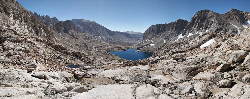 Looking up to Crabtree Pass  Crystal clear water of Lake 12120 as we were making our way down to the use trail  Once on top of Crabtree Pass we had some vistas to partake. Looking back down from whence we came we could see Lake 12129, a good swath of the Miter Basin, Cirque Peak, and most of the bulk of Mt. Langley, with only the actual summit obscured due to our location. Looking west from the high point in the middle of the saddle (which I had climbed from the south side, finding an easy way up) you could see Upper Crabtree Lake, the Dreaded Sand Hill, Discovery Pinnacle, the flank of Mt Chamberlin, and peak 12946. As we sat atop the pass we ate our lunch and came to a consensus of which way were were going to go about making our way up to Discovery Pinnacle from where we were currently. Before we left for the trip we knew there were pretty much two options to get to where we wanted to go. Both options were less than great, but doable. Option one was the most talked about that we had seen and that was to descend Crabtree Pass to upper Crabtree Lake, goto the west end of the lake, then trudge up the sand hill to Discovery Pinnacle. The other option was to try and stay level-ish with Crabtree Pass and then head around the cirque, up through the cliff bands, and then angle up the slope to make your way to Discovery Pinnacle. While we were ruminating a couple of fast packers came up and chatted for a minute. They had a similar goal, but from the look of things they were going to drop down to the lake and take the long way up. We watched them descend and when they made it to the large snow patch on the north side of Upper Crabtree Lake - one went through the patch, the other decided to go up, over and around. Looking down to lake 12129 and Cirque Peak from the top of Crabtree Pass 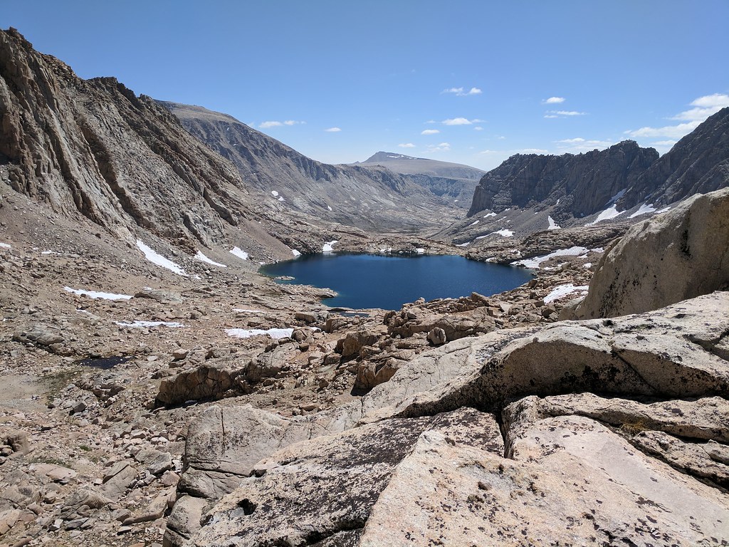 Westward view from atop Crabtree Pass with Upper Crabtree Lake 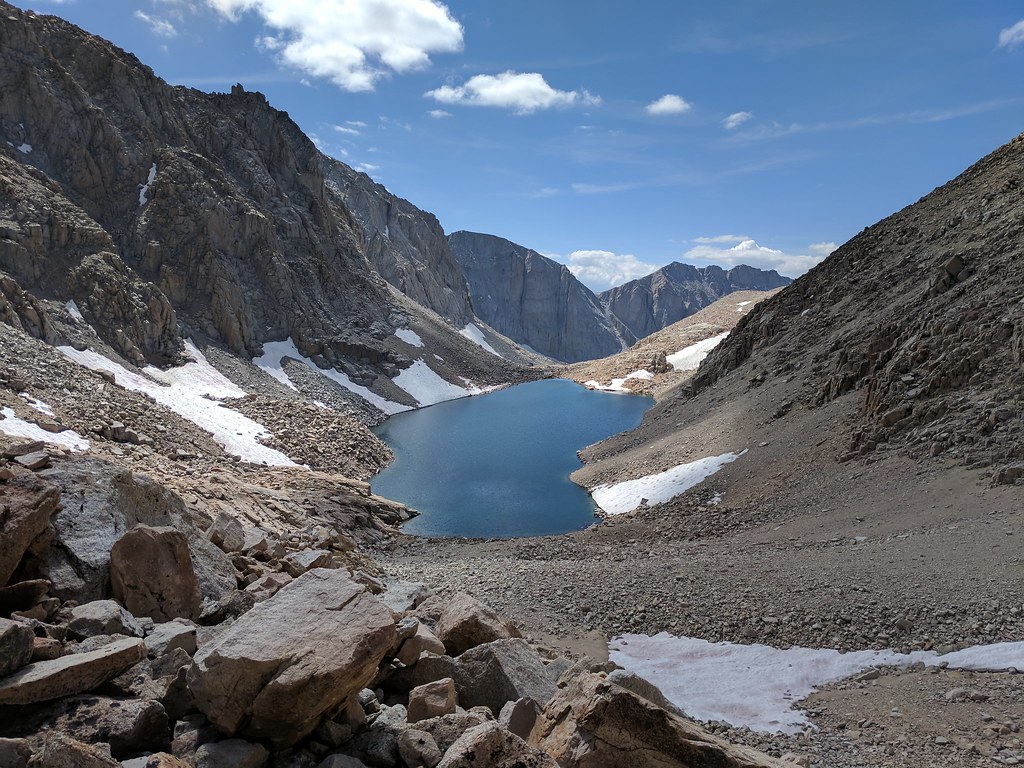 Looking across to the cliff bands and Discovery Pinnacle 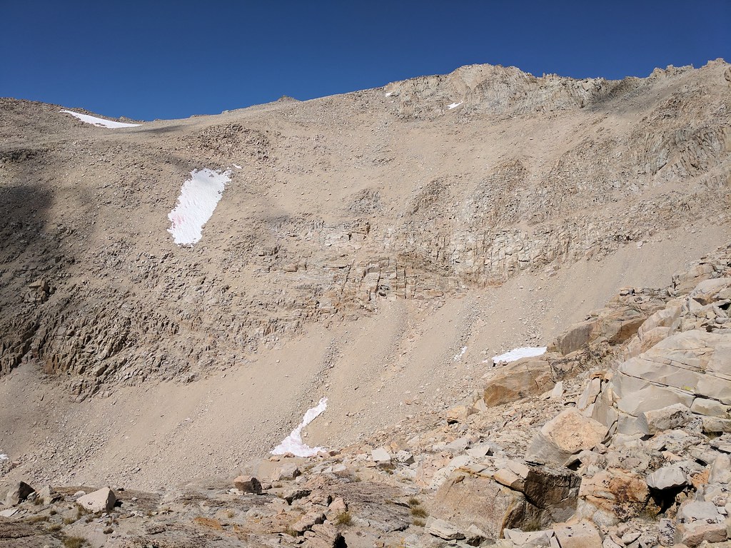 We donned our packs and made our way towards our selected route, through the cliff bands and up. We tried hard to not give up too much elevation, ultimately only losing about 200’ of elevation from the pass until the point where we began to ascend through the cliff bands. It was a lot of boulder hopping, with some scree thrown in for giggles here and there until we reached our low point. Gotta love when the large refrigerator sized boulder your (much slimmer) hiking partner just skipped across shifts when you put your full weight on it, forcing some quick footwork to hop to stable ground and not get ones leg crushed. With that section done it was up and down what looked like small gravel bars from across the way, but ended up being small ridgelines, until we hit our desired start point where we would begin head up through the cliff bands. Once directly below the cliff bands the going looked much easier than it had from a distance, which usually ends up being the case most of the time. We made our way through the first cliff band heading mostly due west until we came to the bottom of the snow patch. From this point we changed directions and headed north east up the hill until we reached our next landmark, another patch of snow, where we once again changed directions and headed north west until right about 13200’ of elevation where we headed due west to the shoulder of the ridgeline the last of the steep stuff. We stopped for a few minutes at this point to catch our breath and orient ourselves towards our next landmark, Discovery Pinnacle. We were at the “easy” part of the sand hill, but still with the elevation, scree and sand it still took a while to transit to the ridgeline east of Discovery Pinnacle. Three hours after starting from Crabtree Pass we were finally on top of the ridgeline of Discovery Pinnacle, and we could see the Main Mt. Whitney Trail below. We quickly found a use path down to the main trail and slid down the hill to the main trail. Closer to the cliff bands after losing a little bit of elevation 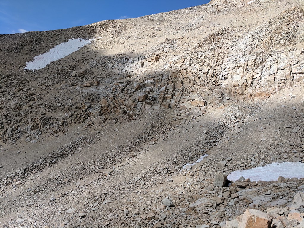 Finally through the cliff bands and looking back from where we started a couple of hours earlier 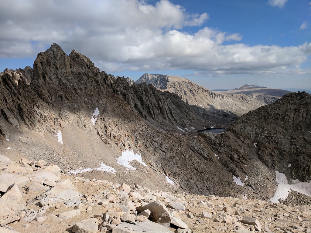 Resting on the ridge above the main trail looking to where we were headed 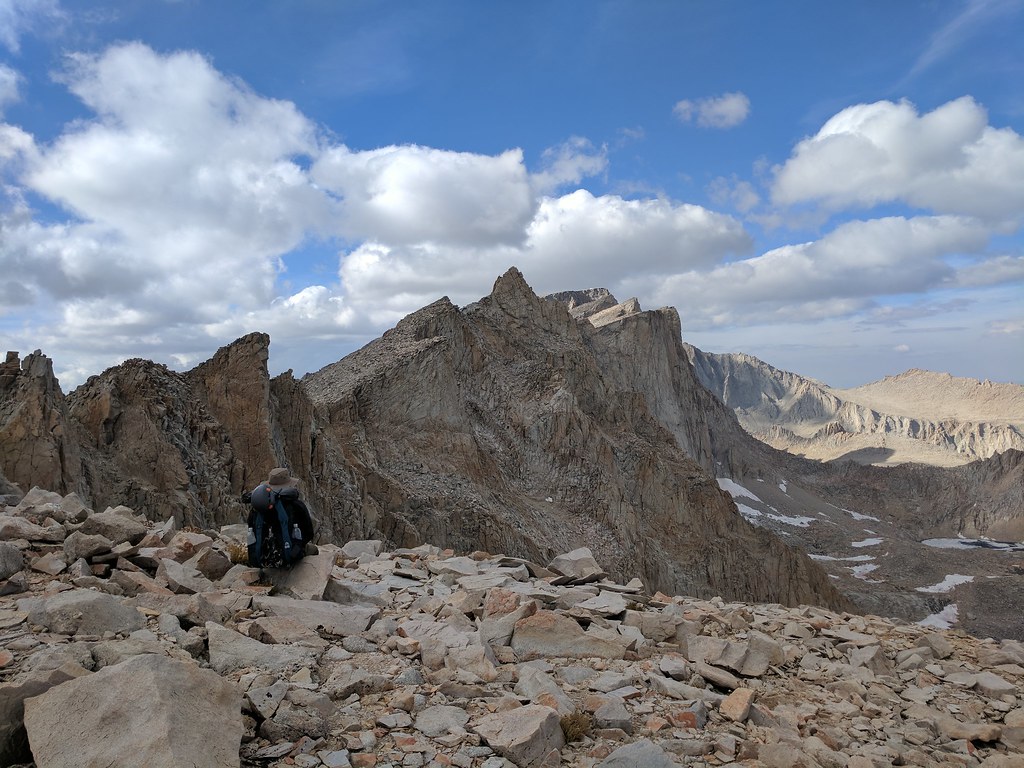 We joined the Main Trail just before Trail Crest. Hey look at this! A real trail! You forget how easy a groomed trail is to hike on until you’ve spent the majority of your day scrambling up the path of least resistance. It’s the small things sometimes. A hiker who had gotten a late start and was heading up solo joined up with us just after trail crest. He asked if we were heading to the summit today (which we were) and if so could he head up with us. We saw no problem with it so we continued on our merry way, our pair now a group of three. The hiker was planning to tag the summit then make his way back down and overnight at the sites just off the jmt below the junction with the main trail so we stopped at the junction so he could leave his pack there and have an easier hike up. At this point I was starting to drag a bit. No headaches, no nausea, just feeling a bit out of energy. Jose and our new addition would pull a bit ahead, and then stop and catch their breath, I would catch up, they would continue on, and so on and so forth. This pattern repeated itself all the way to the summit. Apparently the way Jose and our new friend took up to the last bit of the summit was optional route up which avoided the snow patch on the main trail and cut off some distance. As soon as I saw were were off the main trail and were following ducks I was silently cursing them. Soon enough though it was over and I popped up and there was the summit of Mt. Whitney - complete with the Smithsonian Hut, the large slabs on the peak adorned with a slew of benchmarks, and the views - oh my the views! Its funny how you can see something in a picture hundreds of time, but until you are there seeing it for yourself it finally clicks. I think it’s this experience that draws me back to the mountains, seeing things for myself, seeing all the nuances that the human eye picks up on that are lost in photographs. Trail Crest  Hitchcock Lakes and Guitar Lake from the JMT junction 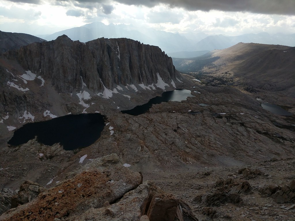 Mt Whitney and Mt Muir 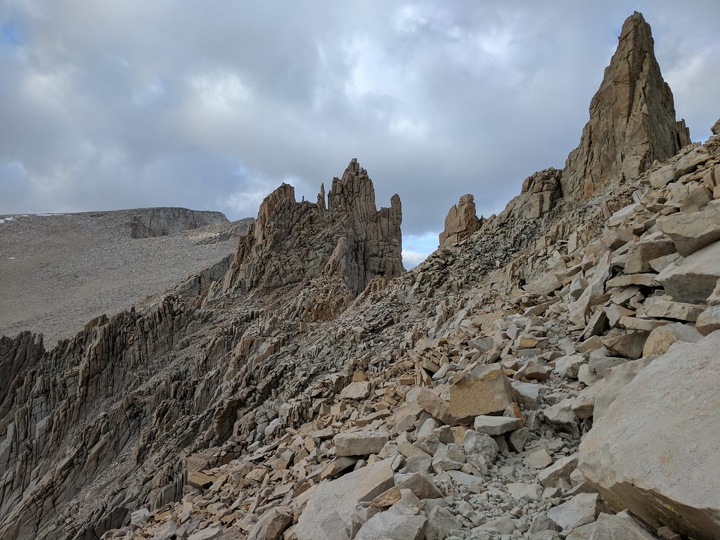 The second window 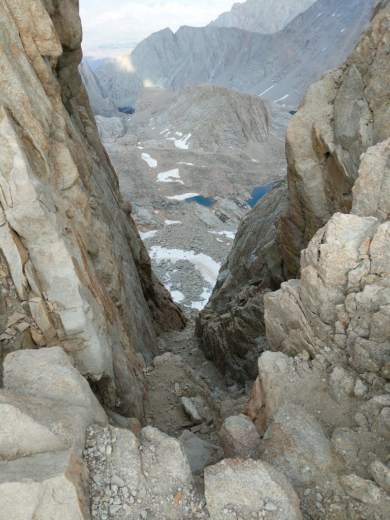 View east from the peak  One of the many benchmarks at the summit 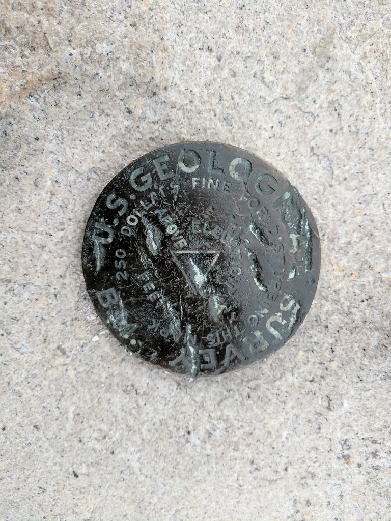 After taking in the vistas that present themselves at the top of the highest peak in the lower 48 and bidding farewell to our new friend that had accompanied us to the summit we had a decision to make. Continue down the Mountaineers Route as we had planned and try to make it to Icerberg Lake or stop and bivy at the summit. Some low clouds had begun to envelop the peak, but there was no call for any sort of weather at the summit in the latest forecast I had gotten from my inreach and with daylight fading quick with the final push to the summit having taken longer than we hand originally planned, and the prospect of descending the Mountaineers Route by headlamp sounding not so fun, we decided to pitch our abodes for the evening in the lee of a couple of rock shelters that had been constructed in the past by other hikers to shield themselves from the ever present summit winds and sleep at the summit. Since we had filled up on water at lake 12129 before Crabtree Pass we both had a little less than a liter of water each by the time we reached the summit. A little short, but there were small snow patches of recent snow that had fallen a few days prior that we could melt and use to supplement our water while we were at the summit. As darkness encroached we made our dinners and had a final cup of coffee before deciding to retire for the evening. With us on the summit was another pair that had came up the main trail a bit later in the day and like us were planning on descending the Mountaineers Route but decided it better to bivy in place and tackle the route down in the morning. Fortunately for us the weather was kind, with only light winds gusting here and there, and the clouds that and enveloped the summit finally dissipating around midnight. I laid out in my bivy with the top open with my face snuggled into my bag, looking at the stars that had finally started to shine when the clouds retreated. I’ve seen good displays of stars before on several backpacking trips, but never had the stars seemed so shine as bright as they did this night on the summit of Mt. Whitney.
|
|
|
 Re: Whitney via the scenic route 9/15-9/17
|
Joined: Jul 2015
Posts: 58
|
OP

Joined: Jul 2015
Posts: 58 |
I awoke to my alarm on Sunday the 17th at 6:00, ensuring I’d make it up out of my bag to wander up to the edge and watch the sunrise. As I walked up the other two fellows who had slept on the summit were still fast asleep in their tents. Not long after though a few other intrepid hikers made their way up from several points to enjoy the sunrise from the top of Mt. Whitney. A woman from Long Beach had left Trail Camp at 2:00 to make it up there, and shortly after we were joined by a fellow whom had camped at Guitar Lake and was finishing his JMT through hike, and lastly an Englishman who was doing the PCT had hiked up from the JMT side as well joined our motley crew to watch the sun slowly slink from below the horizon and finally bathe the whole of the Sierra in its warm rays. While sitting around and chatting it turns out that the woman from Long Beach and the Englishman hiking the PCT had brought up way more water with them than they actually needed for the hike up to the summit. Being that it was going to be extra ballast on the way down that they didn't look forward to carrying, they had originally planned to dump it, but upon hearing that we were a bit short on water offered up their excess to us. This worked out well, as the remained of the liter I had from the night before that I had supplemented with snow melt was now frozen solid since I had neglected to stow it inside my bivy before tucking in for the evening the night before. The Englishman saw me applying my lip balm and asked if he could use some. He explained that he had lost his a few days prior and had a major case of chapped lips. Fortunately I had an extra tube of chapstick in my bear can, so as I went to my campsite to retrieve my water containers I grabbed the chap stick and gave it to the hiker in need. With the sun rising higher in the sky Jose and I said thanks to the generous hikers at the summit for the water and we proceeded back to our campsite to make coffee and breakfast and to begin packing up for our descent down the Mountaineers route. Sun just lighting up the horizon over Lone Pine Peak 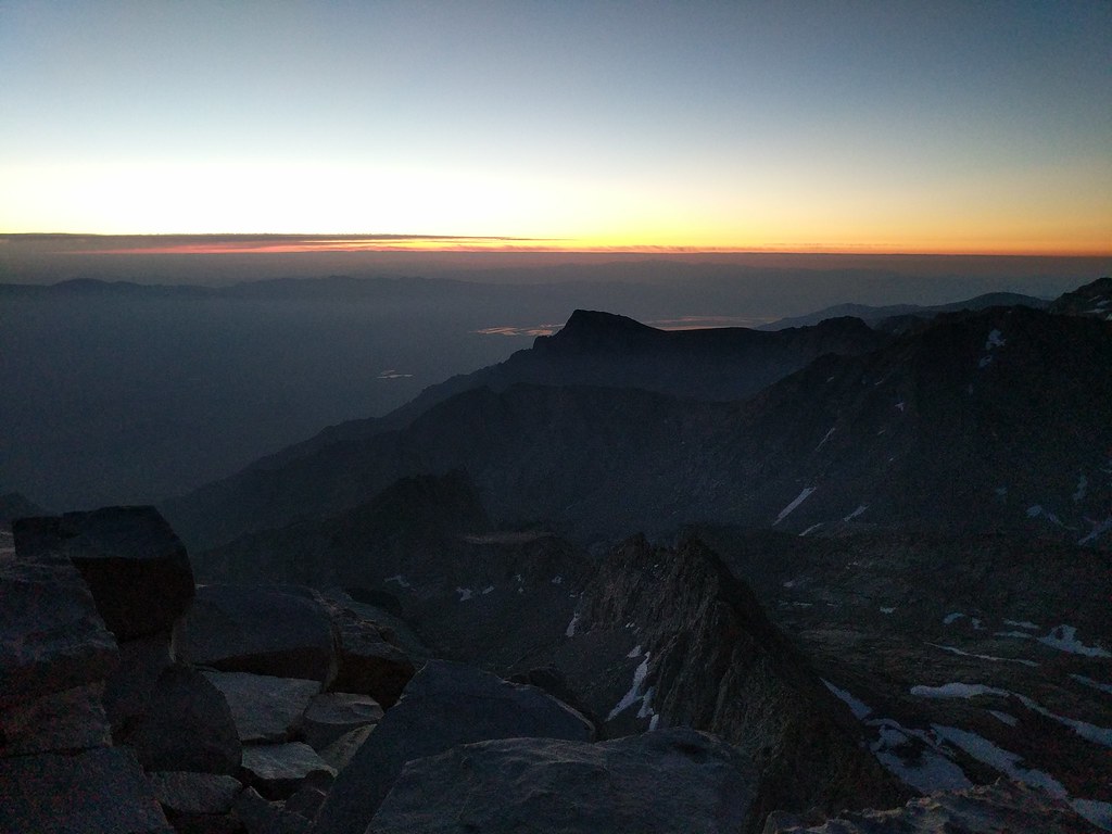 Mt Russell in the early light.  Small group assembled to watch the sunrise 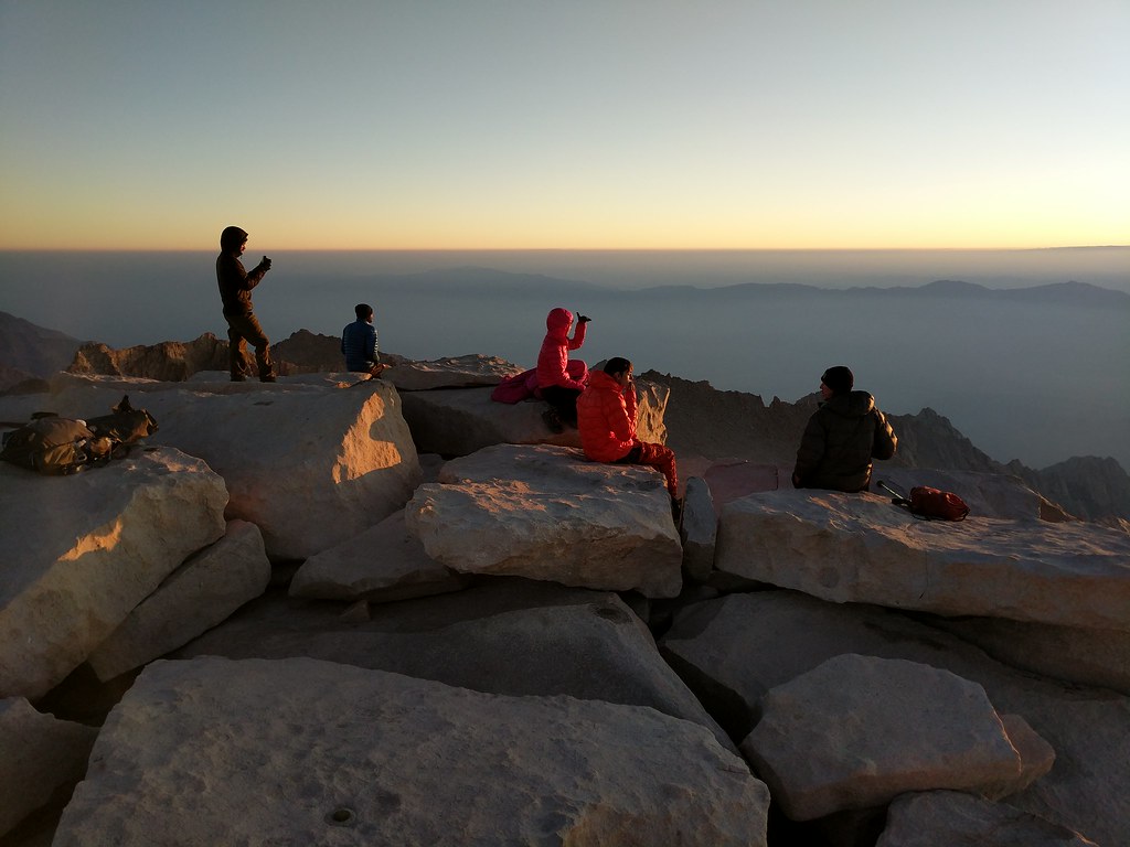 Whitney casting a long shadow to the west 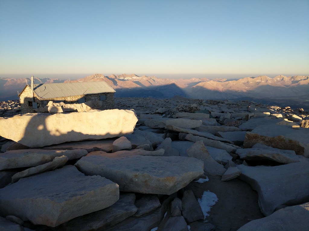 With everything packed up we began our way over towards the top of the final 400 around 9:00. We reached the edge and peered over and saw the route down to the notch. With full packs and neither of us having come up the final 400 before we decided to walk down the edge, looking for a duck that marked the entrance to the “easy walk off” which starts right about where the main trail bends away from the north edge and heads towards the summit proper. We found the duck right where it was supposed to be and took a peek at our proposed route. In a dryer year this route is normally just a class 2 scramble all the way to the notch. Well, this past year hasn't been a dry year so there were still patches of icy snow covered with a thin layer of fresh snow from a storm the previous weekend. Before descending we donned our helmets and microspikes as a little bit of extra traction would not be a bad thing. We started down in earnest, picking our way down slowly until we could see the normal class 2 route disappear into a snowfield that lay a bit further to the west. At the far end of this snow field on top of the ridge we saw the two fellows that had bivied on the summit with us the night before taking a look at the route from their point of view and probably trying to figure out their options at that point. Jose and I continued on, making our way down to the normal class 2 route and slowly picking our way towards the notch. Right before the notch there was a decent sized patch of high angle snow which appeared to start right about the same area of the class 3 route up the final 400. At the top the patch was pretty wide, but steep enough that we didn't feel confident in crossing that far with only microspikes and a trekking pole. So we dropped down a bit and had a go crossing at a spot that was quite a bit shorter. Jose felt a bit uneasy about it and wanted to continue down almost to the very bottom of the snow patch where it was at it’s narrowest. I figured I’d try and see if I could kick some steps across the section where I was at, which at that point was about 12’ wide in total. I had kicked about three steps in, and at the point where I was starting on the fourth I felt the exposure was a bit too much and retreated back from where I had started. What I wouldn't have given for an ice axe at that moment as It would have made cutting steps across trivial. Alas, I didn't have one so I followed Jose’s lead down and we crossed the snow patch at its smallest which was about 3 steps across, with a rock in the center to give a little more purchase. Although technically easier, this lower spot was quite exposed, with little there below to stop yourself if you were to happen to slip. Slowly Jose and I both made it across. There was a lot of small rocks and scree that had the probability of coming loose so I waited for Jose to make it completely across and climb up to the notch before I began. A short time later we were both standing atop the notch, ready to begin our descent of the Mountaineers Route in earnest. First bit we came down from the duck 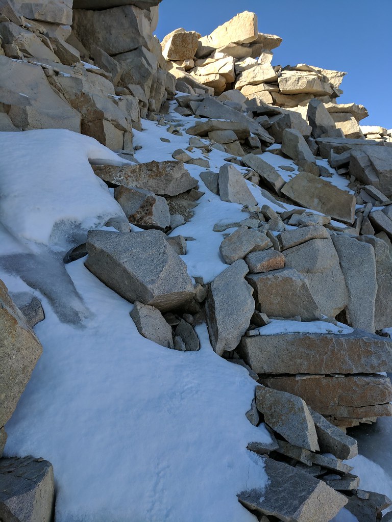 About midway across  Snowpatch before the notch 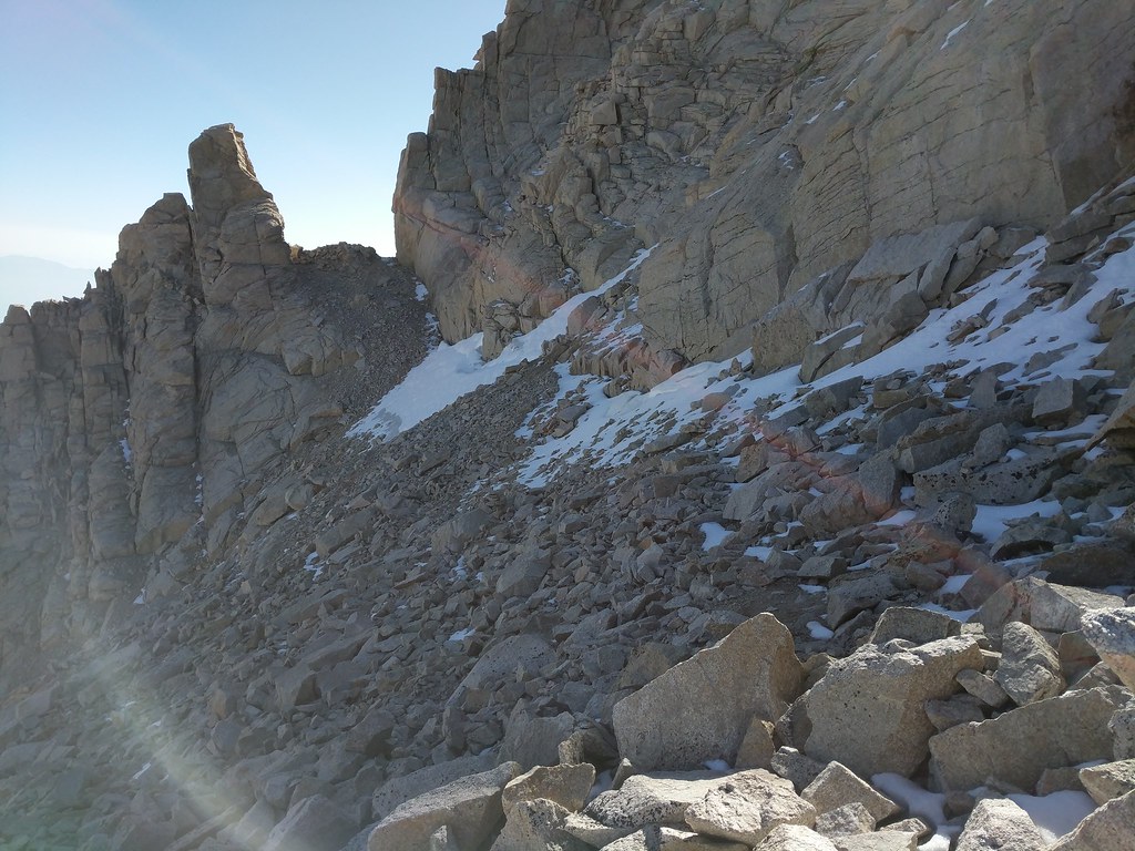 And across the snow patch, looking to where we started 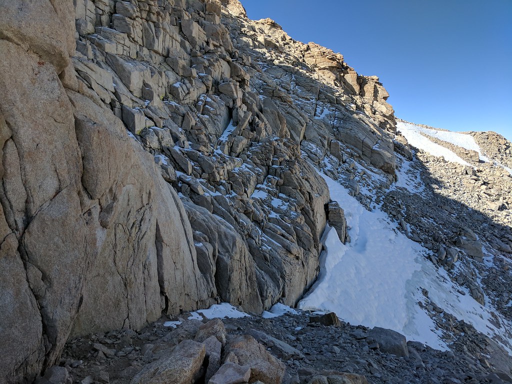 The first part of the MR goes pretty easily. It's steep, but the route is well used so route finding is pretty straight forward. We made good time until we were just above the middle, where there was still a portion of icy snow in the middle of the route. Below us there were two groups coming up - one group of 4 younger guys and second group of a older fellow and a woman. We decided to hang out at the top of the icy patch and let both groups come up, as it was way too easy to accidentally kick a rock loose and send it careening down onto those below us. All in all it took about 30 minutes for both groups to pass us and the route below to be clear. Again we donned our microspikes and slowly made our way down the 100’ section of icy snow with no drama. Once past the icy section we decided to stay to our right and take the approach for the east buttress climbing route which was dry and clear of snow versus the main chute which was still full of snow. The route down through here was definitely a lot steeper than the upper part of the Mountaineers Route that we had just traversed, but we took our time going down and in no time we found ourselves clear of the route and on the shores of Iceberg Lake just a little past noon. At Iceberg Lake we stopped for a bite to eat and to fill up on water for the hike down the rest of the North Fork of Lone Pine Creek Route to our final destination of the day, Whitney Portal. We began our descent, following the use trails down from Iceberg Lake, past the bowl in which Upper Boy Scout Lake sits in, down the slabs and through the edge of Clyde Meadow, along the east side of Lower Boy Scout Lake, descending the Ebersbacher Ledges, making a few crossings of the creek and finally joining the main trail. It’s always funny when you’ve been out for a few days off the beaten path and then suddenly you are in a super popular area and there are a ton of day hikers. The smell of fabric softener and looking how peppy and clean everyone is. Always good for a giggle or two. We made very quick time now that we were on the final stretch of our journey on a superhighway of a trail. We arrived at the end of our journey, Whitney Portal, at 4:10 pm, just a little over 7 hours from when we had started that morning. We used the facilities, picked up a drink from the Portal Store, and then proceeded to hop into Jose’s truck and make the drive from the Portal back up to Horseshoe Meadows to pick up my Truck. Along the way to Horseshoe Meadows we both commented on how neither of us looked forward to ever going up the North Fork of Lone Pine Creek route anytime in the future. Yeah, not any time soon.. Russell and Carillon from the top of the notch 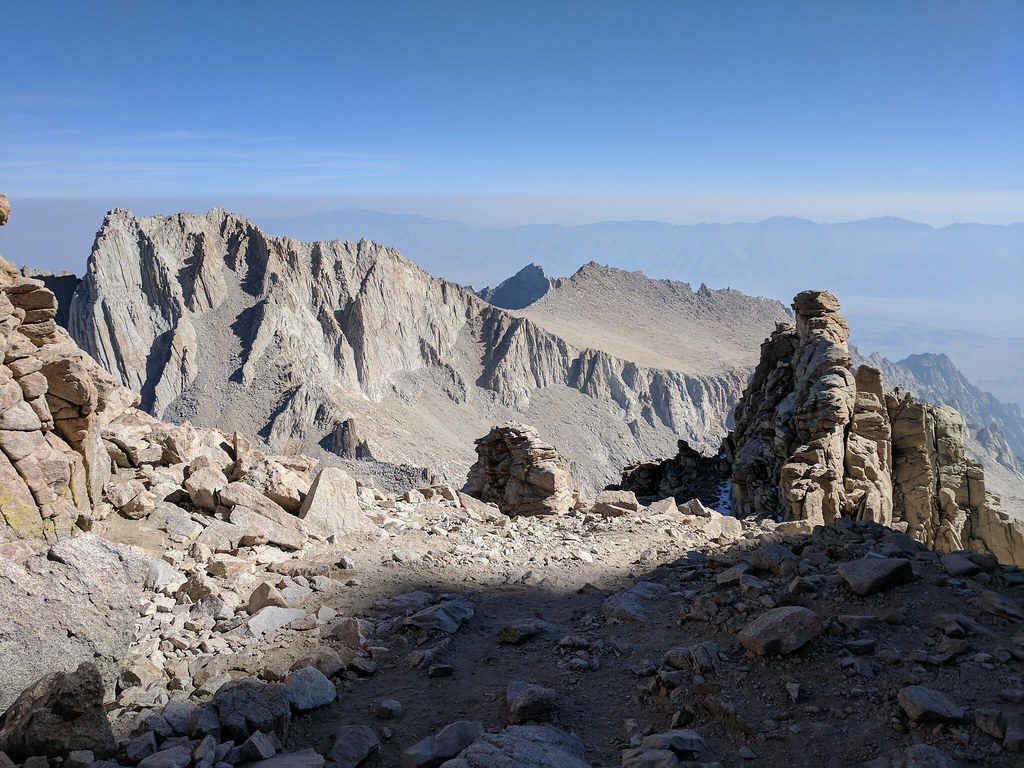 Looking down the MR 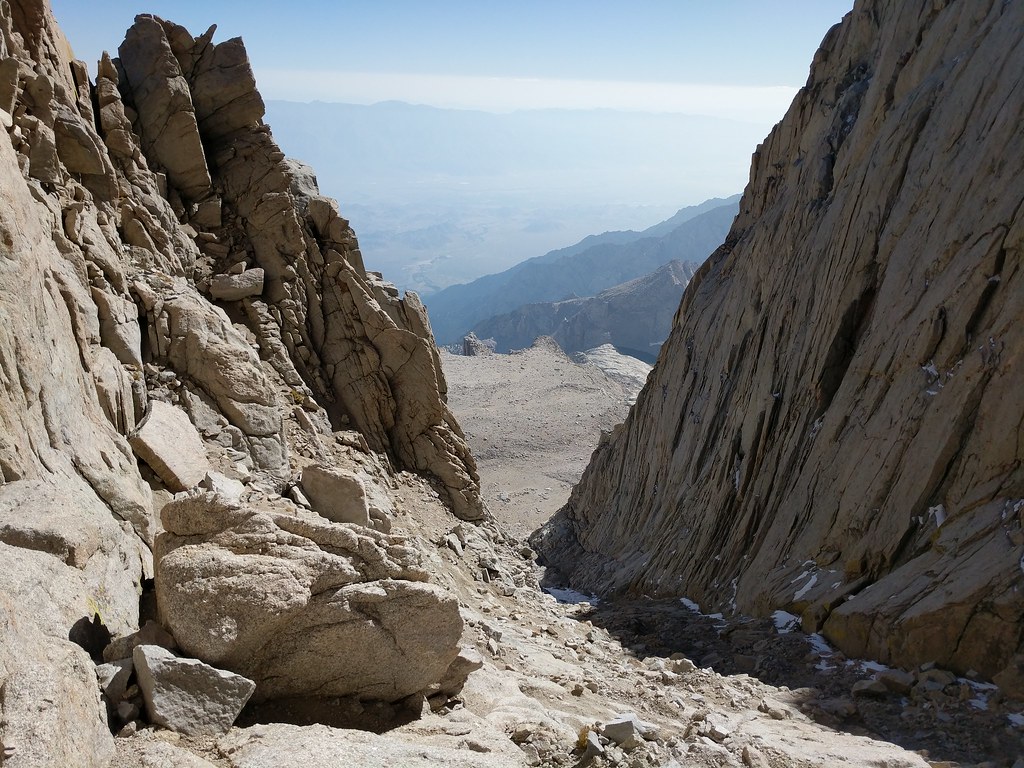 Jose waiting above the icy snowpatch for others to clear that section 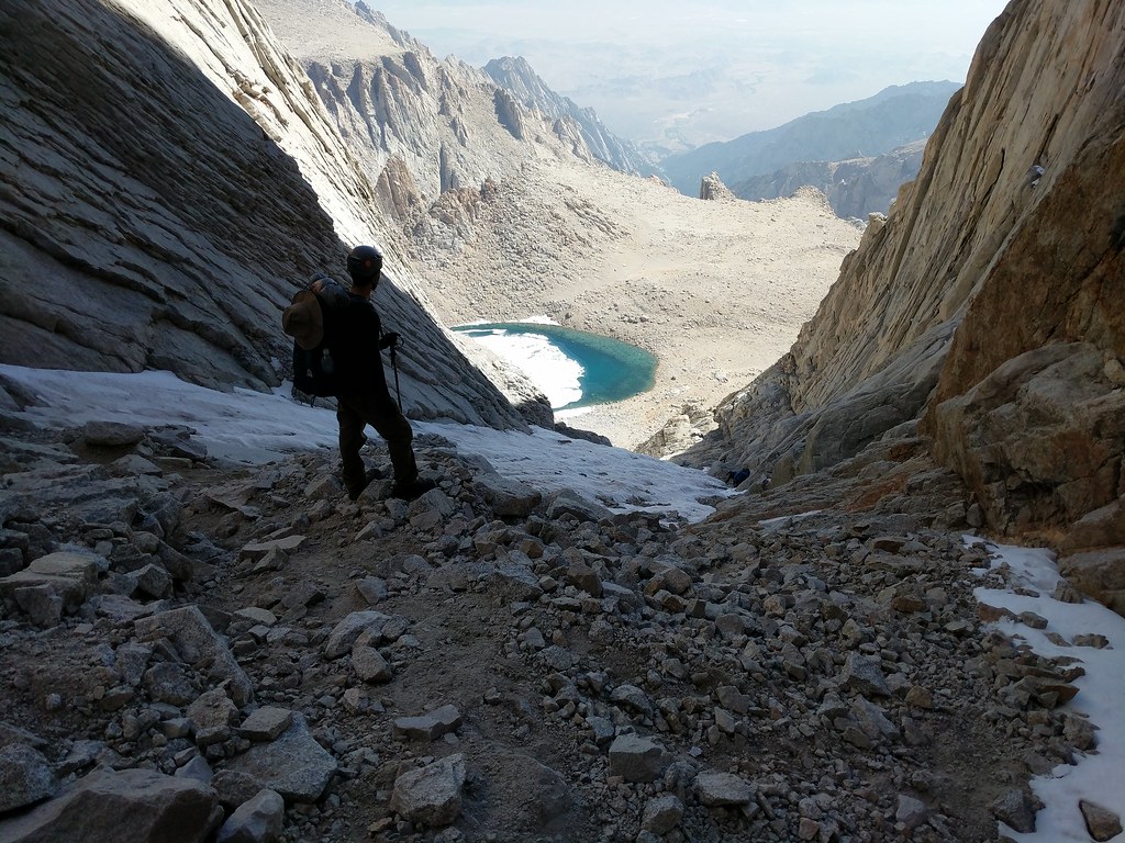 Facing back up to the icy snowpatch 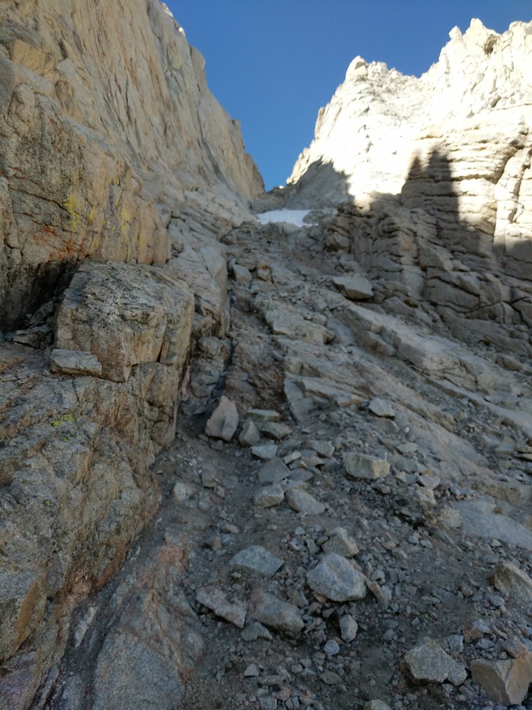 Jose surveying Iceberg Lake and Mt Carillon 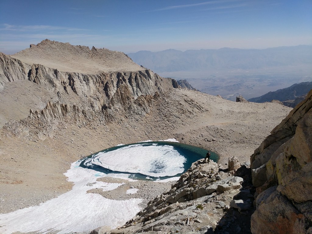 At Iceberg Lake checking out what we had come down. 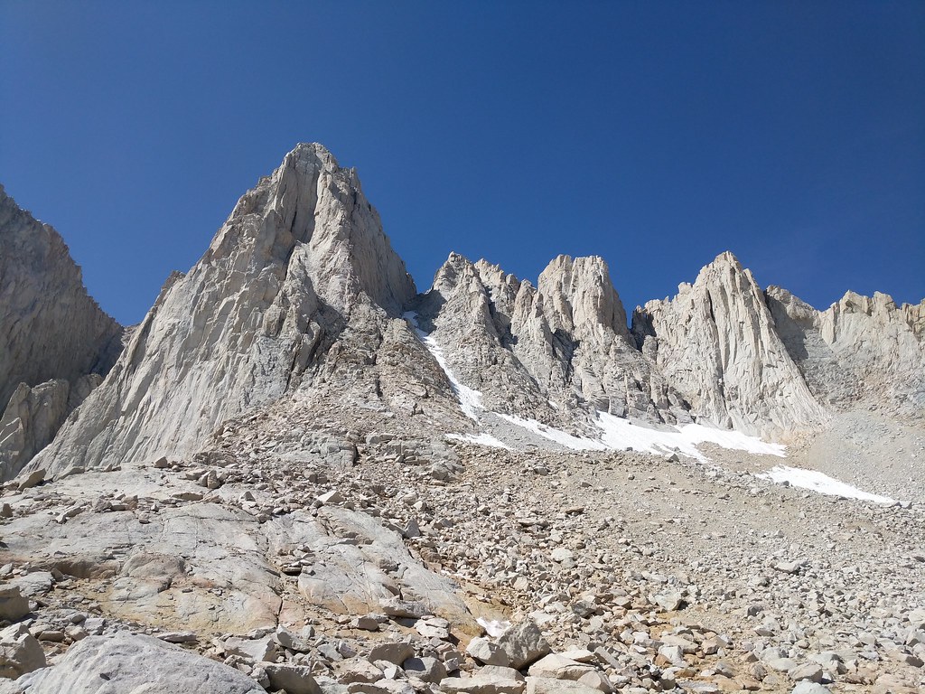 Iceberg Lake with a skin of ice on the surface  Wispy Clouds over Mt Whitney 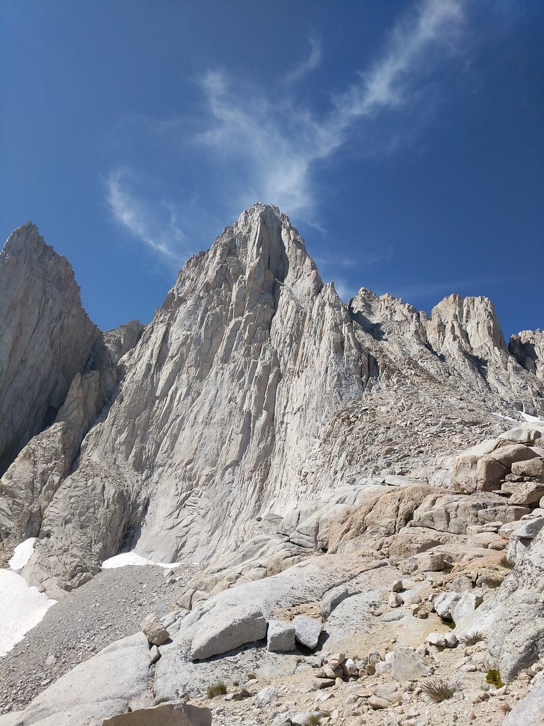 Clyde Meadow 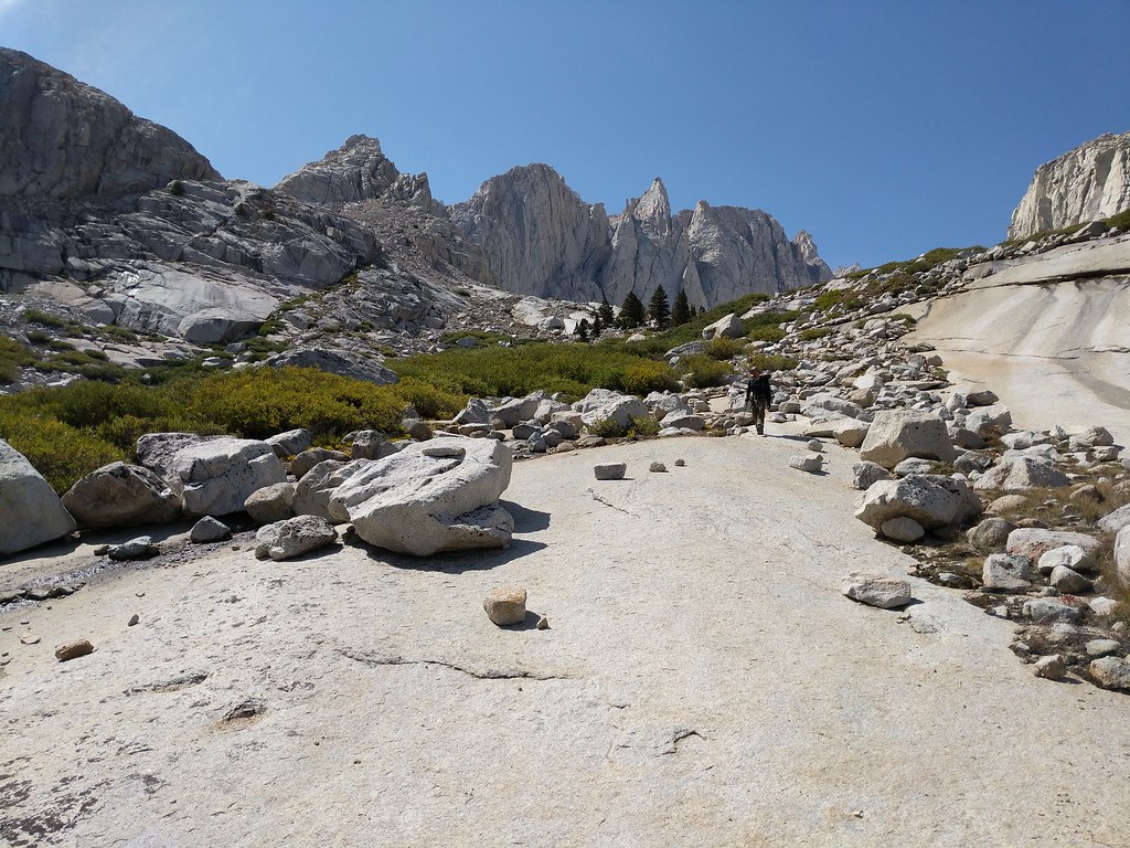 Lower Boyscout Lake 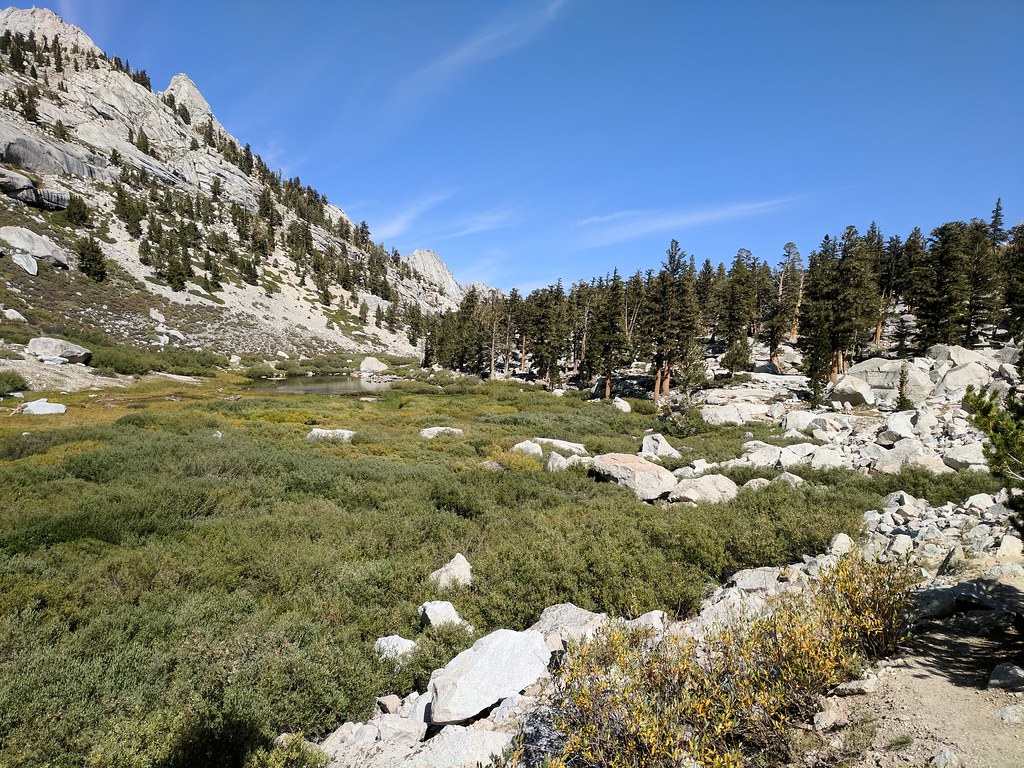 Start of the Ebersbacher Ledges 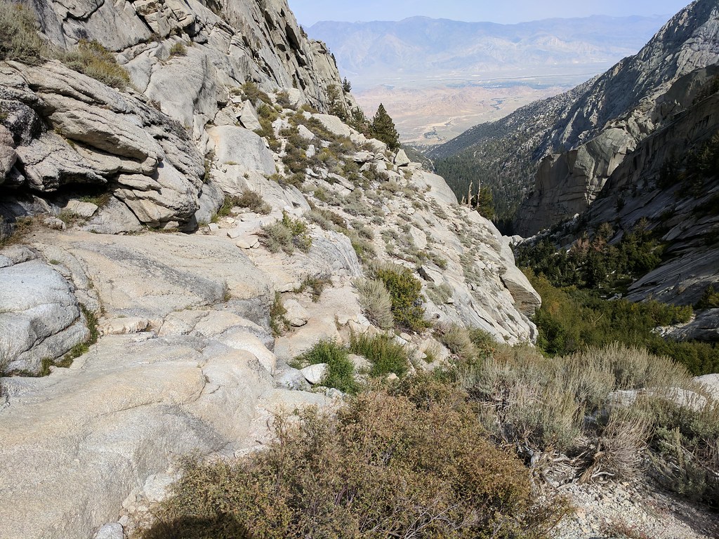 Beginning of the North Fork Route off of the Main Whitney Trail 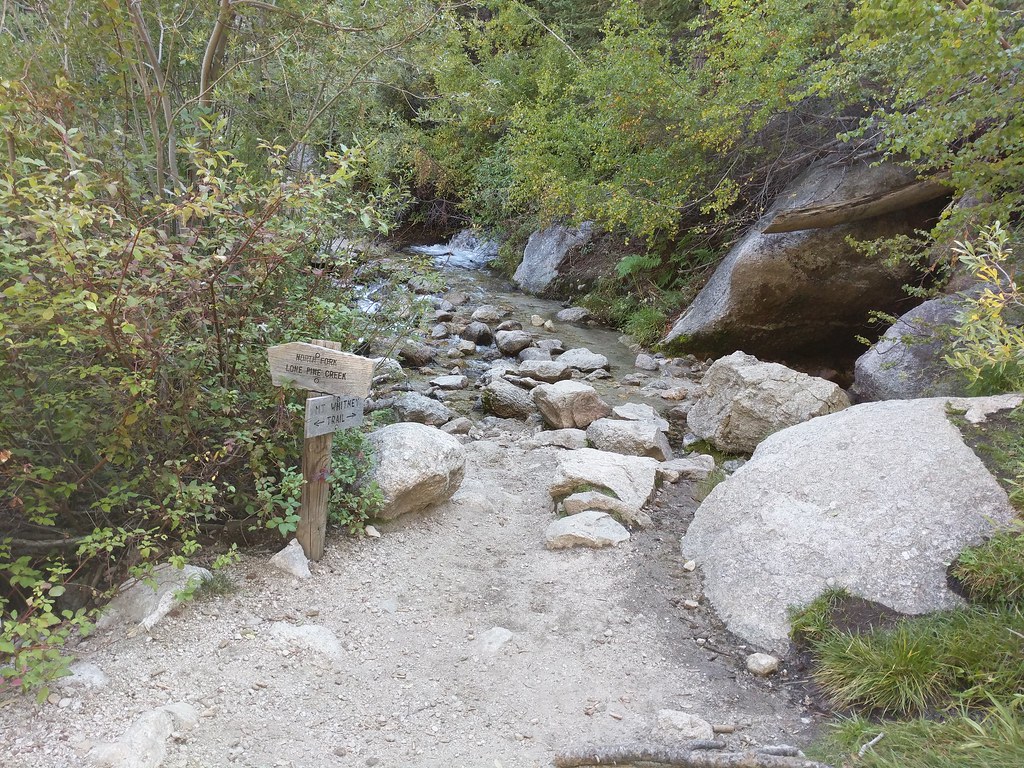 So my take aways from this trip. Love going through Cottonwood Lakes. Always a great place to be, even if just passing through. Have to get back to the Miter Basin and spend some time fishing, exploring the other lakes tucked away up in the corners and tagging a few of the peaks in the area. The “Dreaded Sand Hill” Lives up to its name. When I finally make it up that way again I’ll definitely do it in the reverse order, coming down the sand hIll from Discovery Pinnacle. Sleeping overnight on the summit of Mount Whitney and and watching the sunrise was magical. If you don't have attitude issues and the weather is in your favor while you are up there then try it. If there’s any chance of weather though - don't risk it. They put those lighting warning signs up there on the approach and on the top for a reason. All in all, we had a great trip and saw some areas that we both had wanted to see for a while. This was Jose’s second summit of Mt. Whitney and my first. The main trail with all the red tape and all the people doesn't sound like the type of hike I like to take so I don't think I’ll ever head up that way. I’ve got that traverse from Shepherds to Horseshoe Meadows with some peaks in between to tag still on my list so I’ll be back - but it will again be via another scenic route. Caltopo link to map with planned vs actual routes: https://caltopo.com/m/JT82Full image gallery of my pics from this trip on Flickr: https://flic.kr/s/aHsm852XS5 - There are a few 360° panoramas / photospheres that I shot as well that I couldn't get to embed right in my report. Sunset on the way home by the turn off for Lubken Canyon Road 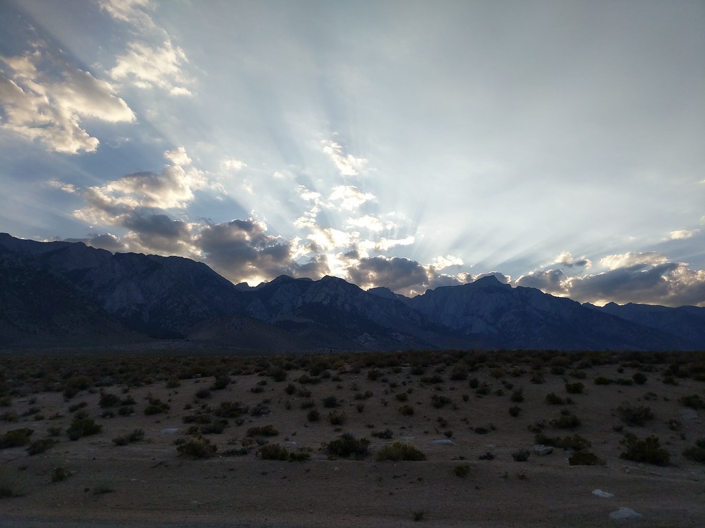
|
|
|
 Re: Whitney via the scenic route 9/15-9/17
|
Joined: Jan 2014
Posts: 32 Likes: 1
|

Joined: Jan 2014
Posts: 32 Likes: 1 |
Congratulations. Absolutely spectacular photos and write up. Great reference guide for future hikers as well.
|
|
|
 Re: Whitney via the scenic route 9/15-9/17
|
Joined: Feb 2013
Posts: 6
|

Joined: Feb 2013
Posts: 6 |
How difficult or easy is the route-finding from lower Soldier Lake up and over the low saddle to the northwest and then into the Miter Basin? Is the route around the west side of the lake preferable to the east side, or does it really matter? Headed to the basin next week and am looking to avoid back-tracking southwest to where the main trail intersects Rock Creek.
Thanks all. Any information would be greatly appreciated.
~Rico
|
|
|
 Re: Whitney via the scenic route 9/15-9/17
|
Joined: Sep 2009
Posts: 8,534 Likes: 107
|

Joined: Sep 2009
Posts: 8,534 Likes: 107 |
Rico, I was there in 2016, and it was pretty easy to climb to the saddle. It really isn't much of a use "trail", but you can see places where people have obviously walked. I recall it was pretty simple to climb that section.
Psycho Kid: I'm a bit late getting around to it, but thanks for posting such a good trip report! Great pictures!
|
|
|
 Re: Whitney via the scenic route 9/15-9/17
|
Joined: Aug 2011
Posts: 584 Likes: 13
|

Joined: Aug 2011
Posts: 584 Likes: 13 |
Psyko, What a fantastic trip. I read it right when you posted, but I realize now that I never complimented your photography, and thank you for sharing. What kind of camera* do you have? *How heavy is it 
@jjoshuagregory (Instagram) for mainly landscape and mountain pics
|
|
|
 Re: Whitney via the scenic route 9/15-9/17
|
Joined: Aug 2014
Posts: 10
|

Joined: Aug 2014
Posts: 10 |
Rico, It's been a few years, but we went around the west side of Lower Soldier Lake until you hit a steep, vegetated drainage that heads north into Miter Basin. The trail fades a bit as you hit the vegetation but there isn't really any other place to go. The drainage section shows up clearly on the google aerial map. It's moderately steep and wet but my memory might be slanted based on the weight of my pack. I think the east side gets you into bushwhacking.
|
|
|
 Re: Whitney via the scenic route 9/15-9/17
|
Joined: Feb 2013
Posts: 6
|

Joined: Feb 2013
Posts: 6 |
Thanks very much for the info smart1 and steve. Much appreciated.
|
|
|
 Re: Whitney via the scenic route 9/15-9/17
|
Joined: Jul 2015
Posts: 58
|
OP

Joined: Jul 2015
Posts: 58 |
Rico,
The use trail that we ended up taking from the northwest corner of lower soldier up to the ridgeline was really easy to find and not hard to stay on. We simply stayed high on the ridge line until we could see the trail next to rock creek and then made our way down the ridge line.
Going around the east side of Lower Soldier up to the gulley would for sure be a muck fest this time of year, as it was all super swampy last year in September.
You can see my planned vs actual route on the caltopo link at the end of my last post in the TR.
Steve,
Thanks! I always try to give back with a trip report with pics when I go out since some of the great trip reports here and on other sites have helped me plan my endeavors.
Snacking Bear,
Thanks again! Oddly enough, this was the first trip I went on where I didnt take a "real" camera, only my Google Pixel XL. It worked out well because it has a great camera built in. The only gripe that I had was that a third party camera app that I had been using bonked and stopped recording raw images the first morning at the trail head.
|
|
|
 Re: Whitney via the scenic route 9/15-9/17
|
Joined: Feb 2013
Posts: 6
|

Joined: Feb 2013
Posts: 6 |
Much appreciated psyko. That's actually very helpful.
Last edited by Rico; 07/17/18 08:25 AM.
|
|
|
 Re: Whitney via the scenic route 9/15-9/17
|
Joined: Jun 2017
Posts: 7
|

Joined: Jun 2017
Posts: 7 |
Beautiful photos and excellent write-up. thanks for sharing your experience with so much detail!
|
|
|
 Re: Whitney via the scenic route 9/15-9/17
|
Joined: Apr 2018
Posts: 19
|

Joined: Apr 2018
Posts: 19 |
Awesome pictures psyko. Thank you for the great write up. Loved reading it and makes me want to try some other areas other then the Main Trail!
Mike
“Getting to the top is optional. Getting down is mandatory.”
- Ed Viesturs
|
|
|
 Re: Whitney via the scenic route 9/15-9/17
|
Joined: Jun 2019
Posts: 3
|

Joined: Jun 2019
Posts: 3 |
Great post and forum with invaluable information. Has anyone made an attempt at Whitney from Cottonwood trail over the New or Old Army Pass? Will be attempting Whitney entering from Cottonwood trail on 7 July with a Whitney exit permit on 13 July. Any trip reports or information would be greatly appreciated. ty
|
|
|
 Re: Whitney via the scenic route 9/15-9/17
|
Joined: Sep 2009
Posts: 8,534 Likes: 107
|

Joined: Sep 2009
Posts: 8,534 Likes: 107 |
I saw a recent report of people going up the snowy New Army Pass on to Mt Langley. I think the pass was there most difficult part. They actually did some rock climbing to get up. But the pass is south-facing, so it ought to be way better in two weeks. Edit: Here you go... http://www.whitneyzone.com/wz/ubbthreads.php/topics/55558
Last edited by Steve C; 06/27/19 01:38 PM.
|
|
|
 Re: Whitney via the scenic route 9/15-9/17
|
Joined: Feb 2011
Posts: 1,572
|

Joined: Feb 2011
Posts: 1,572 |
Psychokid: correct me if I am wrong but could you check the pic above captioned "Above Crabtree Pass"? Looks to my from the angle, aligned with the south shore of Lake 12119, that you must be looking from Whitney PAss, or directly below it.
Wherever you go, there you are. SPOTMe!
|
|
|
|
|