|
0 members (),
49
guests, and
35
robots. |
|
Key:
Admin,
Global Mod,
Mod
|
|
 July trail conditions
|
Joined: Mar 2017
Posts: 21
|
OP

Joined: Mar 2017
Posts: 21 |
I am planning to hike Whitney in mid July and was wondering what you guys thought the trail would be like as far as snow and ice. I know we have had a high snow year, and am curious as to when the trail will be safely hikeable with no special equipment such as crampons or micro spikes.
Our permit request is for July 14.
|
|
|
Re: July trail conditions
|
Joined: Apr 2016
Posts: 256 Likes: 36
|
|
Joined: Apr 2016
Posts: 256 Likes: 36 |
I am planning to hike Whitney in mid July and was wondering what you guys thought the trail would be like as far as snow and ice. I know we have had a high snow year, and am curious as to when the trail will be safely hikeable with no special equipment such as crampons or micro spikes.
Our permit request is for July 14. Hard to know so far away. My guess is that you will need at least microspikes on July 14th. I climbed Whitney on July 4th last year and there was still some snow on the trail toward the top. This year has like twice as much snow...
|
|
|
Re: July trail conditions
|
Joined: Feb 2011
Posts: 1,572
|
|
Joined: Feb 2011
Posts: 1,572 |
Year with snow closest to this was 2011, when switchers were passable about July 12.
Wherever you go, there you are. SPOTMe!
|
|
|
Re: July trail conditions
|
Joined: Sep 2009
Posts: 8,533 Likes: 107
|
|
Joined: Sep 2009
Posts: 8,533 Likes: 107 |
Thanks, Saltydog for pointing that out.
BenC, there are people who successfully hike the trail when it is packed down snow like you will find, with only hiking boots. But I think microspikes would be the best option once the switchbacks are starting to be used.
|
|
|
Re: July trail conditions
|
Joined: Nov 2009
Posts: 1,037 Likes: 6
|
|
Joined: Nov 2009
Posts: 1,037 Likes: 6 |
for a snowpack graph to compare yearly snowfalls, see link be sure to change check boxes to: 1982-1983 (max) 2010-2011 last big year 2016-2016 current year click DRAW CHART Snowplot you can see that as of this moment, 2010-2011 and this year are about the same on the Snowpack chart. However, the accumulation during the rest of the spring, warmer weather melt rates, and local conditions may dramatically change what is there. I was on Whitney with the last big summer snow remnant on 8/7/2011 and west side had areas of knee deep snow, but a good groove cut through it by many other feet.
|
|
|
Re: July trail conditions
|
Joined: Feb 2011
Posts: 1,572
|
|
Joined: Feb 2011
Posts: 1,572 |
Noticed something very interesting: the linked site is interactive. You can check the year you would like to compare (or uncheck to remove), reload the page and you get the new comparison. Add the year you were there, and you can compare it with this year. Add 2010-2011 (our last wet year) and get very interesting result.
Wherever you go, there you are. SPOTMe!
|
|
|
Re: July trail conditions
|
Joined: Feb 2011
Posts: 1,572
|
|
Joined: Feb 2011
Posts: 1,572 |
I just spent a very pleasant and informative hour or so playing with the historical and current snowpack curves at http://cdec.water.ca.gov/cdecapp/snowapp/swcchart.action and I highly recommend it. First, the site is interactive: you can add and subtract years and reset to get the comparisons you would like to look at. If you last hiked the trail in say 2011, the year Mile, Mile and a Half was filmed, or if you have seen the film, you can select that year, click the " Draw Chart" button near the top on the left, and it will add that curve. You can then find your date this year and see what the snow was like that year on the same date. (The film starts about July 10.) A couple of other details are worth noting. Look at the monster year of 1983, your index year, the average year and say 2011 and you will probably note that they all zero out at about the same place, about mid July. In fact, the monster year of 1983 looks like it zeros out earlier than the average year and some of the index years I looked at, like 2011 and my trip in 2013. Another interesting thing is that things have definitely changed in the last few weeks. A month ago, we were right on track with that monster 1983. Now, we are looking like 2011. In fact in the north, this years curve has caught and crossed below 2011. Moreover, the only year I could find in which the actual peak snowpack went much beyond April 1 - into May in fact - was 1983. So I will sneak a few inches out on a limb here and offer the following. I think things are looking up. Oh I know there is another dump going on right now up north, but central and south are looking better. And anything can happen between now and next Tuesday, never mind June, But based on the curves I am looking at, I do not expect everything to get pushed out 4-6 weeks over an average year, even if something does happen. Why? A purely technical analysis: those curves are not parallel: they all begin and end at roughly the same points: big snowpack years do not tend to start earlier and end later; they are steeper at each end. So yeah, the melt and runoff are gonna be pretty spectacular, and June 1 will be deep, but the differences between snow pack on a given date in different years will get smaller and smaller until they disappear on or around the same date year after year. Or that is the trend, the tendency. Yeah I know, the sno-tels are only in certain places, and those places are where most of the land is: they are not in the passes where the going is toughest, and snow will hang in those passes much later than indicated by the overall snow pack curves. But the sno-tels are where most of the trail is, so I think this is a pretty good indicator of what most of the trail will be like. Oh yes, the passes will probably be motherbears all summer, but thats a lot different from projecting that most of the trail will involve snow travel for most of the summer. So, bottom line prediction right now: June 1 to August 1 looks like 2011, not 1983.
Wherever you go, there you are. SPOTMe!
|
|
|
Re: July trail conditions
|
Joined: Nov 2016
Posts: 5
|
|
Joined: Nov 2016
Posts: 5 |
Any idea where the three areas start and end? North, Central, and South.
|
|
|
Re: July trail conditions
|
Joined: Apr 2012
Posts: 579 Likes: 3
|
|
Joined: Apr 2012
Posts: 579 Likes: 3 |
Any idea where the three areas start and end? North, Central, and South. This link shows the data in "chart" form, as well as showing a map of the three areas. http://cdec.water.ca.gov/cdecapp/snowapp/sweq.actionI find this site is slow on the week-ends, and does not update until Monday.
|
|
|
Re: July trail conditions
|
Joined: Feb 2011
Posts: 1,572
|
|
Joined: Feb 2011
Posts: 1,572 |
I find that map very difficult to read, can't identify enough on it to be useful: but the text seems to indicate that the line between central and south, west of the Crest is the Merced/ San Joaq Divide, to over near Mono Pass and Bloody Canyon/Walker Lake east of the Crest, ie the southern/southeastern boundary of Yosemite.
Last edited by saltydog; 03/25/17 02:18 PM.
Wherever you go, there you are. SPOTMe!
|
|
|
Re: July trail conditions
|
Joined: Jul 2016
Posts: 40
|
|
Joined: Jul 2016
Posts: 40 |
When microspikes become necessary, say during the switchbacks if required, how much would they need to be taken off and put back on, on the way to the summit? I would be worried about patches of bare rock bending up something like a pair of Kahtoola microspikes. But I wouldn't want to be taking them off and putting them back on half a dozen times on the way up and again on the way down, either.
I'm asking because I have a July 17th day hike this year and have never gone up with snow on the ground (mid-September 2 years ago and 3rd week of August last year). I do use trekking poles so that might mitigate some slipping, and the Merrell footwear has reasonable depth lugs on them.
|
|
|
Re: July trail conditions
|
Joined: Nov 2009
Posts: 1,037 Likes: 6
|
|
Joined: Nov 2009
Posts: 1,037 Likes: 6 |
I would be worried about patches of bare rock bending up something like a pair of Kahtoola microspikes. But I wouldn't want to be taking them off and putting them back on half a dozen times on the way up and again on the way down, either.
It is really easy to take them off and on. AND, I have never had a set slip off when in use. Amazing, actually. I took a several years-old and several-times used set of Kahtoolas to some gnarly rocky/icy sections in Nepal in 2014 and they still look brand new. Not bent. Amazing, actually.
|
|
|
Re: July trail conditions
|
Joined: Sep 2009
Posts: 8,533 Likes: 107
|
|
Joined: Sep 2009
Posts: 8,533 Likes: 107 |
I think by mid-July, your microspikes should be fine. Most people wear their spikes over rock for some distances. I think you can judge when to put them on and take them off. You wouldn't need them to cross short patches of snow, and you don't need to take them off to walk a 50 yard stretch of dry trail.
|
|
|
Re: July trail conditions
|
Joined: Mar 2014
Posts: 155 Likes: 1
|
|
Joined: Mar 2014
Posts: 155 Likes: 1 |
How much would micros-pikes need to be taken off and put back on. Crampons are great for kick-stepping up steep, solid snow fields like the Chute (MMWT) and Gully (MR). Hard packed, boot tracked trail with mixed snow & rock is actually where micro-spikes excel. I don't if micro-spikes were designed to be walked on rock, but no one I know (including myself) ever takes them off until you've obviously gotten below snow line. If you did, you might average .25 mph due to stopping every time you came across a patch of snow or got back out into some clearings. On the way up, once you put them on, keep them on (unless you come across a completely wind blown clear area like the summit plateau). On the way down, ditto: keep them on until you take them off after you've passed the last of mixed snow/ice. Top of Glen pass, 6/4/2016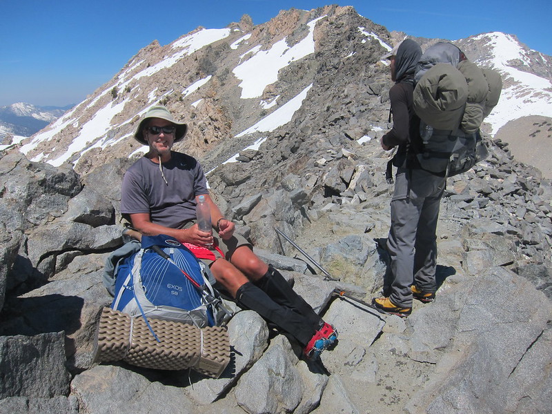 http://www.highsierratopix.com/community/viewtopic.php?f=1&t=14472 http://www.highsierratopix.com/community/viewtopic.php?f=1&t=14472
Last edited by Hobbes; 04/11/17 12:05 PM.
|
|
|
|
|


