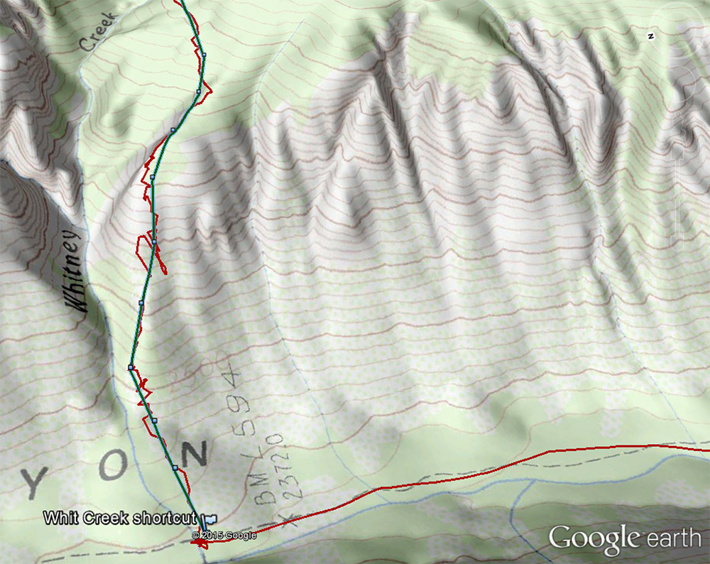
Lyndon, I feel responsible for the tough time you had with the shortcut. I am pretty sure you took a route farther to the left (north) on the steepest part of the climb. I am really sorry it was so much trouble.
No worries Steve! I really should've spent more time researching the route and should've brought a detail mapped of the top section. It was a good wakeup-call for both of us (too much reliance on the GPS)!
After we finished, I think I saw a better route for us and we had debated whether or not to take that line while we were standing there. I thought your tracks went further to the right (I assumed we were following your tracks anyway), but once they disappeared, it wasn't sure where we needed to go. I guess I could've descended some, so that the GPS wasn't bouncing around to better idea of where the route was.
Your route is the green one. Our route is in red.