Friday June 5 - Leave San Diego after work and drive up to the mountain, stopping Saturday at 2 AM about 0.75 miles away from the trailhead due to snowy dirt road conditions.
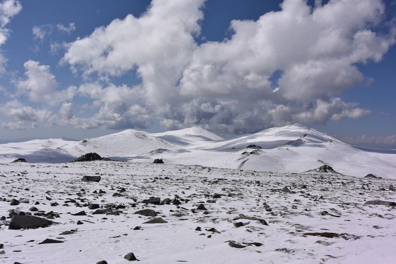
Saturday June 6 - Sleep in and wake up to a snow white tundra at 11700 feet.
It's a beautiful partly cloudy day with no wind - perfect for hiking. Though mountain-forecast.com says snow possible... There's a couple inches of unconsolidated snow on the ground and it's easy enough to hike through with just boots on.
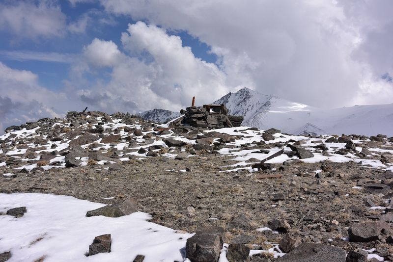
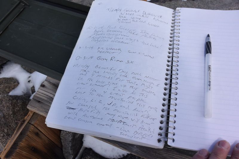
About 1.5 miles up the trail, I depart for a quick tag of Mt Barcroft. The summit register hadn't been signed since October 2014. I head down Barcroft straight for the old observatory.
Around noon, clouds roll in and it starts snowing graupel: large styrofoam balls of snow. There are two snowshoe tracks that I follow until about 1300 or so, and meet the two snowshoers descending. The snowfall and wind have picked up as the visibility decreases. We exchange pleasantries and I continue the ascent. About a minute later a crack of thunder booms. I pause to consider my options. The sound came northeast of me and I feel comfortable going up. The snow and wind are erasing the snowshoe tracks, but from here it's only 1000 feet of vertical straight up the southeast face.
I press on, and hear a buzzing sound. At first I thought it was just the wind against the synthetic material of my jacket, but then I feel pain on my scalp - like pins and needles. I put my hand to my head and the pain (and buzzing) stop. I take my hand off - buzz and pain. What a cool (and scary) feeling. I'm in an electrically charged storm cloud. I quickly descend 40 vertical feet and get low. The weather is forcing me to descend. I wait five minutes; the cloud clears and visibility improves. I decide to risk it - head for the summit quickly. I ascend straight up - the snow provides an easy shortcut over the switchback road. Thunder cracks every few minutes, but no electrical buzzing on the rest of the way up.
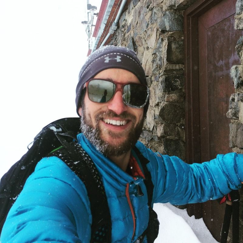
I tag the leeward side of the summit hut and don't bother looking around for the register. I take a picture, put on another layer, and have a drink and bite before heading back down. Visibility has been reduced to less than 40 feet and I can't discern the snowy ground from the cloudy sky - it's all white.
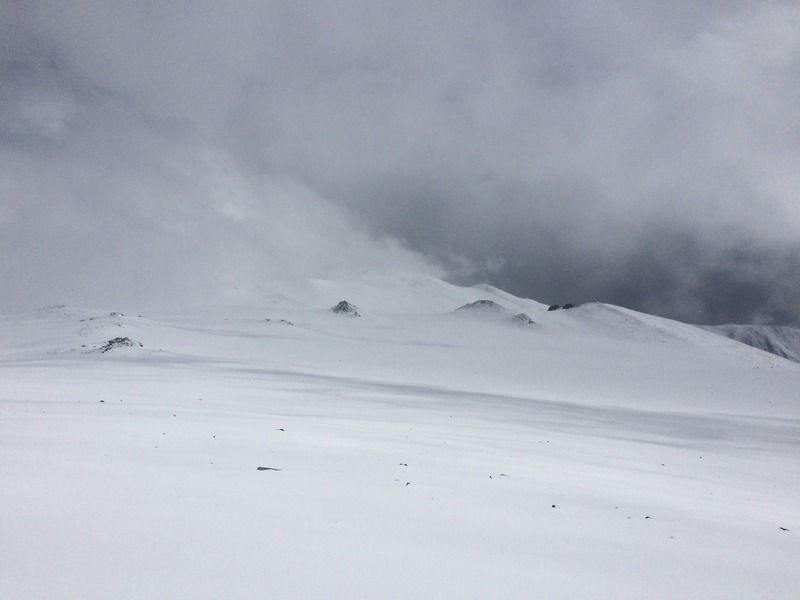
For the next two hours I slowly descend in whiteout conditions, using the GPS app and compass on my phone to navigate. The extra inches of snowfall also slow my progress. I haven't eaten much today - I'm exhausted due to low caloric intake and poor acclimatization. Around 1630 the storm breaks and the glorious sun reappears. It's beautiful out but I'm too tired to take pictures. I press on to my mini checkpoints: the observatory, Barcroft Station, the trailhead gate, and finally reach the car. It starts right up - no marmots have chewed any critical hoses, and I put chains on to assist me out of the 3 new inches of snow that have fallen.
I took a dangerous risk in continuing my ascent, but it was a risk I was willing to take. I saw no lightning and the sound of thunder didn't come closer to me. Had I not been solo, I would've turned around immediately.
Timesheet:
0835 - Begin hiking 0.75 miles from trailhead.
0854 - Reach trailhead gate.
0932 - Depart trail and head to Mt Barcroft.
1017 - Summit Mt Barcroft (13040 feet).
1103 - Back on trail near defunct observatory.
1211 - Reach White Mountain Wilderness sign at ~12860 feet.
1425 - Summit White Mountain Peak (14252 feet).
1602 - Reach White Mountain Wilderness sign at ~12860 feet.
1746 - Pass defunct observatory.
1805 - Pass Barcroft Research Station.
1903 - Reach trailhead gate.
1934 - Make it back to the car.
I awoke to this:
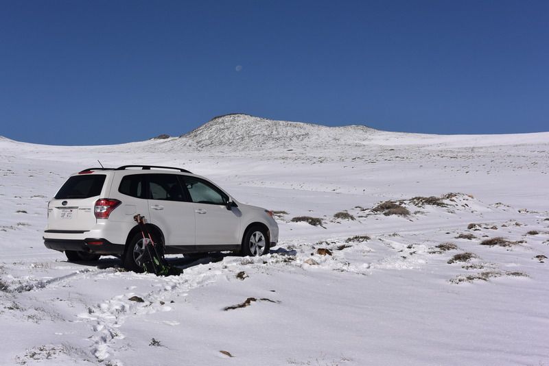
Subaru in its natural habitat:
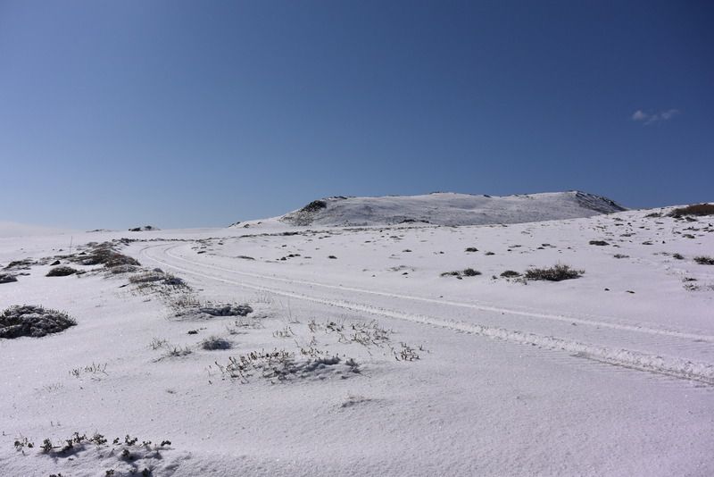
White mountains:
Barcroft summit with White Mountain Peak in the background:
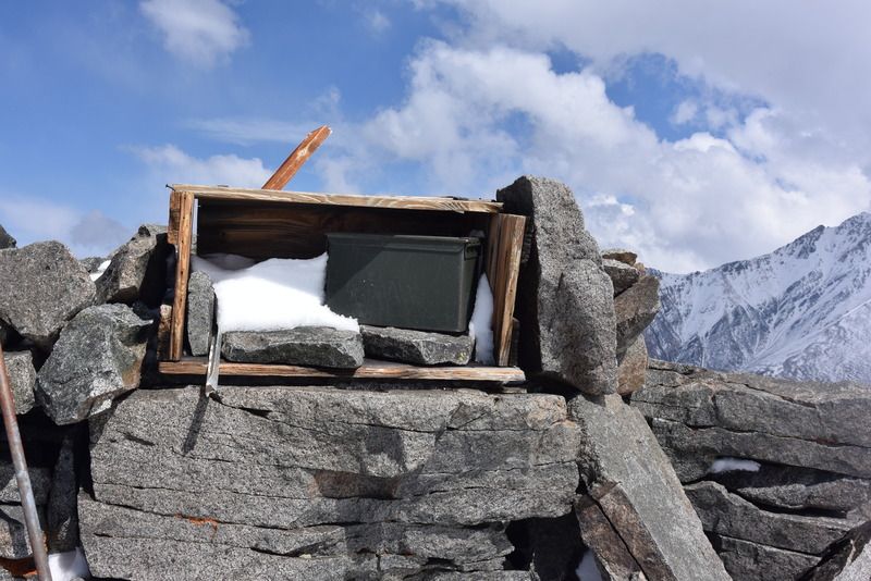
Barcroft summit box:
Barcroft summit register:
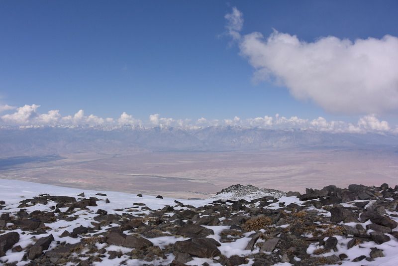
View across Owens Valley to the Sierras:
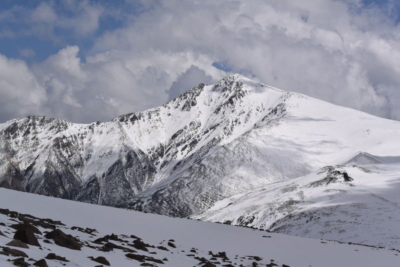
White Mountain Peak:
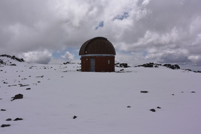
Observatory:
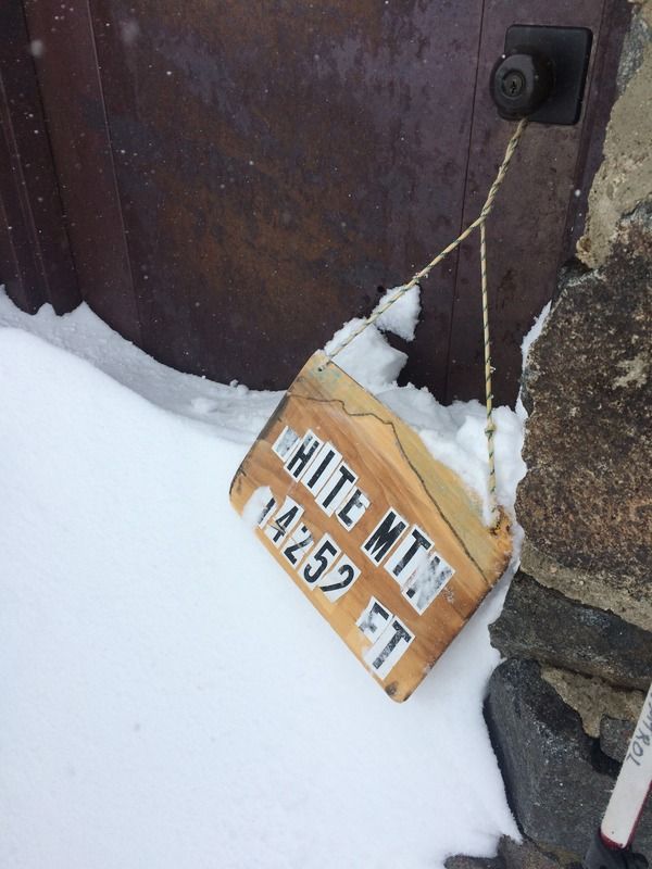
White Mountain Peak summit hut:
Summit selfie:
A break in the clouds:
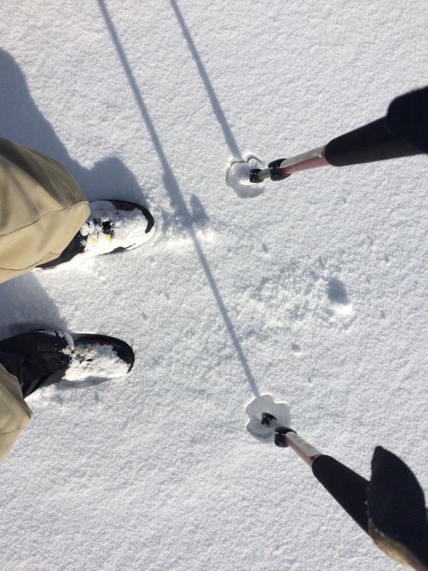
Finally, the end: