Mt Whitney Webcam
Mt Williamson Webcam
Who's Online Now
0 members (), 71 guests, and 3 robots.
Key: Admin, Global Mod, Mod
Previous Thread
Next Thread
Print Thread
Mt. Dana and Minaret Lake Hikes
#43673 07/26/15 10:28 PM
Joined: Apr 2012
Posts: 579
Likes: 3
OP Offline
Joined: Apr 2012
Posts: 579
Likes: 3
Spent a few days last week at Mammoth Lakes, and enjoyed two day hikes:

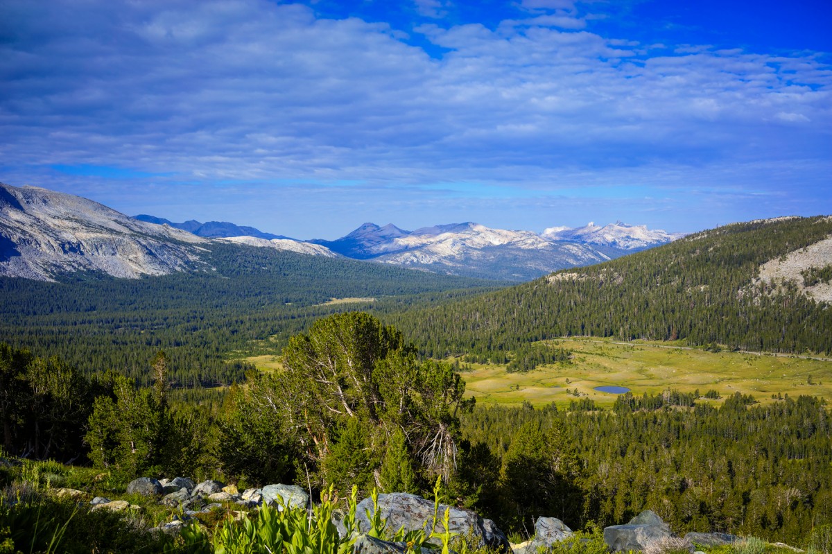
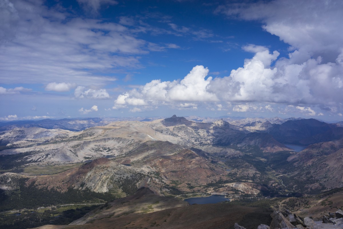
First, up Mt. Dana. This is not a long hike, but it is steep. According to my GPS ~3.35 miles each way, with over 3K' elevation gain. Since there are a couple of flat spots, this hike is fairly steep. Going up is not so bad, but many, many, many big steps to contend with going down. Great acclimization hike due to altitude, but painful decent. For me, it was a "two fer". First and last grin

Following pictures are taken in order of assent. Near bottom, near mid point, and from the top.


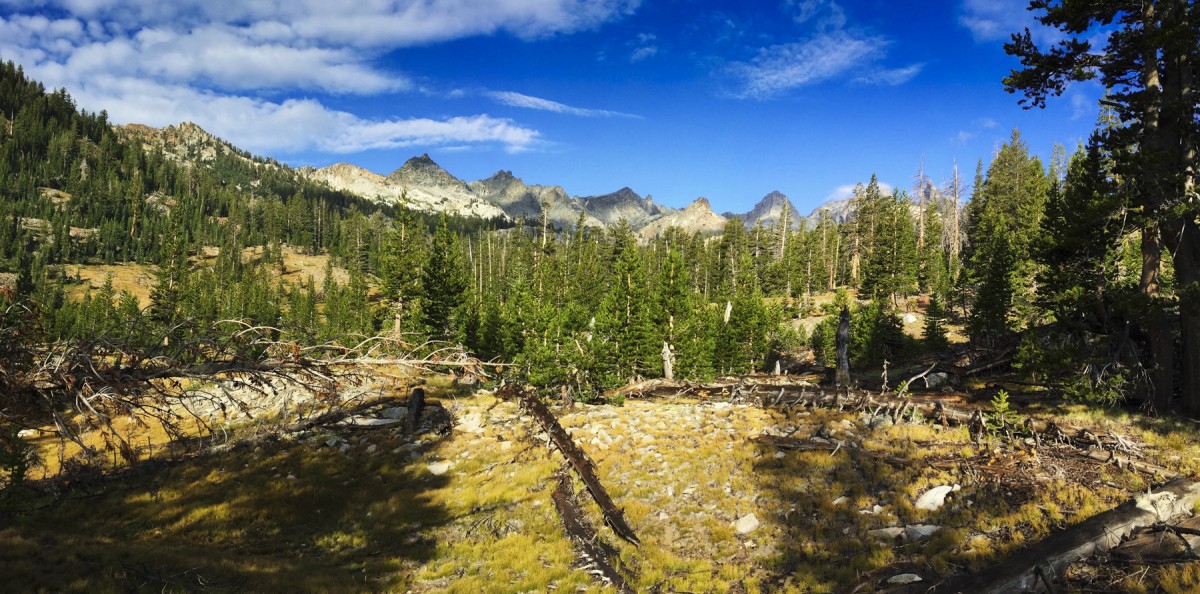
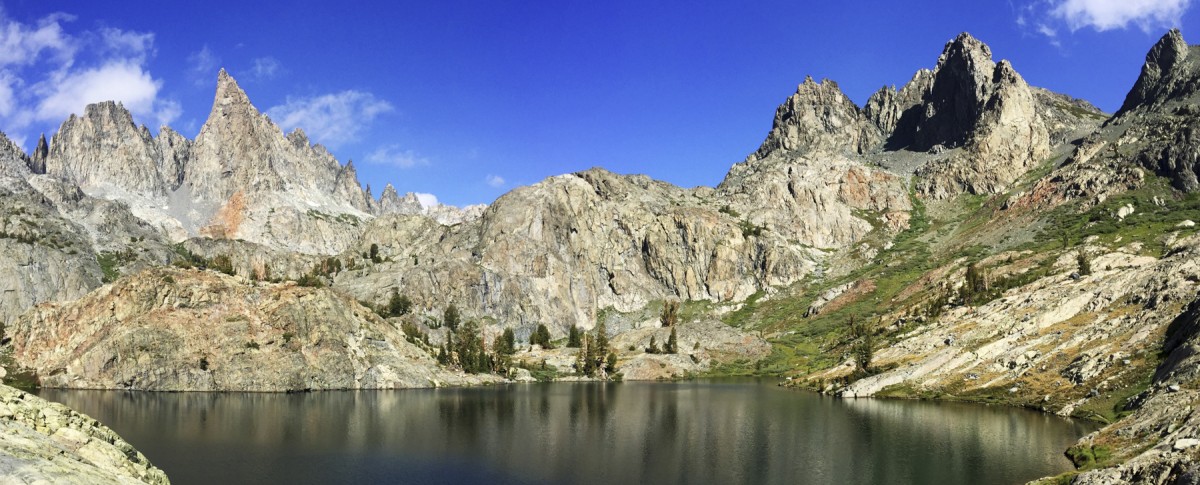
Second hike was from Devil's Postpile to Minaret Lake. ~ 8 miles one way, but only ~2K' elevation gain. Most of the trail is soft to walk on, shaded, and a pleasure to hike. Not so many hikers on the trail, but I did meet 7 campers at Minaret Lake. 5 were going on to Cecile Lake, and possibly on to Iceberg Lake. More rain was predicted, so I chose to head back by going cross country toward the east, and intersected the Minaret Lake trail a couple of miles from the Lake. Made a nice loop. Following pictures are taken in the order of the assent. Highly recommended hike. I will likely do it again, perhaps the next time going on to Cecile Lake and possibly Iceberg Lake.


Last edited by John Sims; 07/26/15 10:33 PM.
Re: Mt. Dana and Minaret Lake Hikes
John Sims #43675 07/26/15 11:41 PM
Joined: Sep 2009
Posts: 8,529
Likes: 107
S
Offline
S
Joined: Sep 2009
Posts: 8,529
Likes: 107
John, do you still have the gps track of your Mt Dana hike? I have a partial one where I followed the trail pretty well, but when I put on my rain parka on the descent, my gps apparently stopped recording the track.

I would like to create a good gpx file for anyone who might want it, but mine is only good above 10,600'

Here's what I have: Gmap4 map/Dana gpx

Re: Mt. Dana and Minaret Lake Hikes
Steve C #43678 07/27/15 07:11 AM
Joined: Sep 2011
Posts: 1,158
Offline
Joined: Sep 2011
Posts: 1,158
Nice photos, John. Minaret Lake is a heck of a long day hike. My wife and kids are doing Mt. Dana next Saturday, my knees hurt just reading your description of the descent. grin eek

Last edited by SierraNevada; 07/27/15 07:12 AM.
Re: Mt. Dana and Minaret Lake Hikes
Steve C #43683 07/27/15 08:58 AM
Joined: Apr 2012
Posts: 579
Likes: 3
OP Offline
Joined: Apr 2012
Posts: 579
Likes: 3
Hey Steve,

GPX route can be found here:

Mt Dana gpx

The lower section of the trail is well worn. Only the last 25% (toward top) will anyone likely get off trail. Also, the park has errected large cairns to help people get back to the trail. I have a few "wonky" points, but it should still be helpful.

GPX of Minaret Lake can be found here:

Lake Minaret GPX


Last edited by John Sims; 07/27/15 09:02 AM. Reason: add (toward top)
Re: Mt. Dana and Minaret Lake Hikes
SierraNevada #43684 07/27/15 09:00 AM
Joined: Apr 2012
Posts: 579
Likes: 3
OP Offline
Joined: Apr 2012
Posts: 579
Likes: 3
Originally Posted By: SierraNevada
Nice photos, John. Minaret Lake is a heck of a long day hike. My wife and kids are doing Mt. Dana next Saturday, my knees hurt just reading your description of the descent. grin eek


Thanks Sierra,

My knees did hurt cry By the time I got back to the car I could easily hike faster going uphill than I could going down hill. Even on a gentle slope. Hope your wife and kids have long legs smile

Re: Mt. Dana and Minaret Lake Hikes
John Sims #43686 07/27/15 09:15 AM
Joined: Aug 2012
Posts: 671
Offline
Joined: Aug 2012
Posts: 671
Great photos as usual John!

After hiking Dana last year, we immediately hopped into the car, drove into the park to see Toulomne Meadows then drove home, for about 8 hrs of sitting. My legs hurt for nearly a week.

My GPS tracked it at 5.8 roundtrip.
http://www.hikinggeek.com/2014/07/19/mt-dana-trip-report-july-19-2014/#photos

Re: Mt. Dana and Minaret Lake Hikes
63ChevyII.com #43693 07/27/15 04:56 PM
Joined: Apr 2012
Posts: 579
Likes: 3
OP Offline
Joined: Apr 2012
Posts: 579
Likes: 3
Originally Posted By: 63ChevyII.com


Hey Chevy,

Not sure about the accuracy of GPS. My legs/knees tell me it is over 22 miles. Whitney is easier grin cry

Re: Mt. Dana and Minaret Lake Hikes
John Sims #43694 07/27/15 05:13 PM
Joined: Apr 2012
Posts: 579
Likes: 3
OP Offline
Joined: Apr 2012
Posts: 579
Likes: 3
Hey Steve,

Another version of the GPS route. This was taken using a Garmin Edge 705. The earlier gpx file was produced using GPS4Cam (an iPhone app that adds Lat/Long to photos taken with cameras that have no gps). This one is cleaner (but only one way).

Mt. Dana from Garmin 705

John


Link Copied to Clipboard
Powered by UBB.threads™ PHP Forum Software 7.7.4
(Release build 20200307)
Responsive Width:

PHP: 7.4.33 Page Time: 0.048s Queries: 31 (0.043s) Memory: 0.6141 MB (Peak: 0.6926 MB) Data Comp: Off Server Time: 2025-03-14 07:33:39 UTC
Valid HTML 5 and Valid CSS