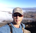
What I did instead of San Gorgonio yesterday was Telegraph Peak via Icehouse Canyon. Really tough hike, 13-14 miles (I was using 2 different tracking apps that had different readings), and about 4500 feet of cumulative elevation gain.
A dedicated GPS has some problems within that canyon. My Garmin usually has mileage distortions...usually much different than what I actually walk...usually higher. It does track accurately. I use it all the time mark down trees and trail damage within the canyon.
The 3Ts is a good substitute for Vivian Creek, a better one is ECBO, which requires a bit of cross country travel from Cucamonga Saddle to Bighorn Peak.