|
0 members (),
49
guests, and
35
robots. |
|
Key:
Admin,
Global Mod,
Mod
|
|
 Snowpack
|
Joined: Feb 2011
Posts: 1,572
|
OP

Joined: Feb 2011
Posts: 1,572 |
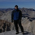
I know its early, but its looking like the third dry year in a row, so far. Check this out Will my bivvy at Edison Lake last August become a permanent campsite? 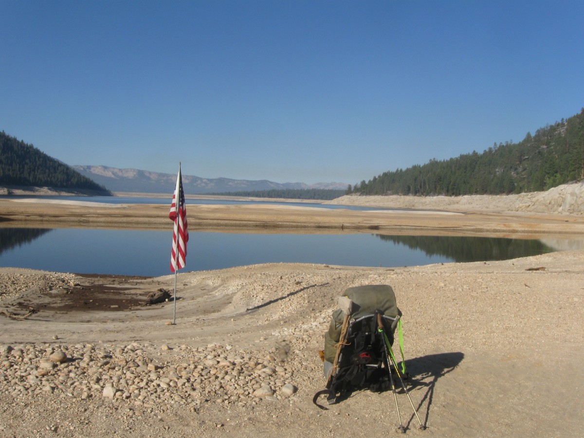 Yep, that's in the middle of the lake. Blue Grouse dug the SPOT signal from this point.
Wherever you go, there you are. SPOTMe!
|
|
|
Re: Snowpack
|
Joined: Sep 2009
Posts: 8,533 Likes: 107
|
|
Joined: Sep 2009
Posts: 8,533 Likes: 107 |
Salty, what is the link you wanted to include?
|
|
|
Re: Snowpack
|
Joined: Nov 2009
Posts: 1,037 Likes: 6
|
|
Joined: Nov 2009
Posts: 1,037 Likes: 6 |
Not the same as your picture, but even back east it is dry. This reservoir in the rainy Virginia mountains is way down, lots of shore not normally seen. What happened to global warming and storms? Picture from ridge on the AT between Tinkers Cliff and McAfee Knob on the way to Dragons Tooth, ( so-called Triple Crown, just got back last night)  Uploaded with ImageShack.us
|
|
|
Re: Snowpack
|
Joined: Feb 2011
Posts: 1,572
|
|
OP
Joined: Feb 2011
Posts: 1,572 |
Wherever you go, there you are. SPOTMe!
|
|
|
Re: Snowpack
|
Joined: Feb 2011
Posts: 1,572
|
|
OP
Joined: Feb 2011
Posts: 1,572 |
Not the same as your picture, but even back east it is dry. This reservoir in the rainy Virginia mountains is way down, lots of shore not normally seen. What happened to global warming and storms?
Picture from ridge on the AT between Tinkers Cliff and McAfee Knob on the way to Dragons Tooth, ( so-called Triple Crown, just got back last night) Climate change manifests differently at different times: not necessarily more storms, or more rain. Maybe here fewer, more intense storms, there fewer, weaker storms, etc. One projection is that Europe will get a lot colder and snowier, due to shutdown of the Gulf Stream.
Wherever you go, there you are. SPOTMe!
|
|
|
Re: Snowpack
|
Joined: Nov 2009
Posts: 1,037 Likes: 6
|
|
Joined: Nov 2009
Posts: 1,037 Likes: 6 |
yeah, I know that. I was just being snide.
it is interesting though, to read journals and books about Polar explorers and walers and how much hundred of miles of ice coverage varied over the years for causes we still do not completely understand, even with satellites and too much data mining at times.
Some of those polar fluctuation were, of course, not global change but macro-regional from fluctuations in gyri of the Gulf Stream near Greenland, or its terminus even as far north as Novaya Zemlya.
I'd like to hear if anyone can now take a wooden sailing vessel through the Northwest Passage like Roald Amundsen did. He was the first, but had to winter over partway there.
|
|
|
Re: Snowpack
|
Joined: Sep 2011
Posts: 1,158
|
|
Joined: Sep 2011
Posts: 1,158 |
yeah, I know that. I was just being snide.
it is interesting though, to read journals and books about Polar explorers and walers and how much hundred of miles of ice coverage varied over the years for causes we still do not completely understand, even with satellites and too much data mining at times.
Some of those polar fluctuation were, of course, not global change but macro-regional from fluctuations in gyri of the Gulf Stream near Greenland, or its terminus even as far north as Novaya Zemlya.
I'd like to hear if anyone can now take a wooden sailing vessel through the Northwest Passage like Roald Amundsen did. He was the first, but had to winter over partway there. Bit of a jump from drought in California and Virginia to Polar ice caps, but I'll go for the ride. First off, Amundsen did not sail through, he skiied the last 800 kilometers, and his adventure went on for multiple years 1903-1906 where he was iced in over for months at a time. Although polar ice coverage varies widely from year to year, his odds would be greatly improved today. In the summer of 2000, two Canadian ships took advantage of thinning summer ice cover on the Arctic Ocean to make the crossing. In 2006 the cruise liner MS Bremen successfully ran the Northwest Passage, helped by satellite images telling where sea ice was. In January 2010, the ongoing reduction in the Arctic sea ice led telecoms cable specialist Kodiak-Kenai Cable to propose the laying of a fiberoptic cable connecting London and Tokyo, by way of the Northwest Passage, saying the proposed system would nearly cut in half the time it takes to send messages from the United Kingdom to Japan. In 2013 the first large sea freighter MS Nordic Orion was able to use the passage. Climate change is manifesting itself most noticeably in the arctic and antarctic regions, as predicted. The scientific evidence is overwhelming, but I don't think Steve wants to launch a debate on that topic so I won't start linking to dozens of peer reviewed articles on ice cores, permafrost melting, and ice shelf breakup. In the end, the scientific method will never be able to prove that humans are causing climate change just like the scientific method can't prove that smoking causes lung cancer. This issue has turned into a mostly party line belief in science vs an obsession to cast doubt. Doubt is easy, just look in the sky, I don't see any greenhouse gas and it was a cool day today.
|
|
|
Re: Snowpack
|
Joined: Sep 2009
Posts: 8,533 Likes: 107
|
|
Joined: Sep 2009
Posts: 8,533 Likes: 107 |
" ...just look in the sky, I don't see any greenhouse gas and it was a cool day today." Now where have I seen someone write like that? The numbers are not looking good starting out this winter season. At least there is some snow in the Sierra. This from Monday -- Whitney is the peak on the horizon just left of center. The Palissade Crest is the closest ridge.  Here's South Lake (I think). 
|
|
|
Re: Snowpack
|
Joined: Nov 2009
Posts: 1,037 Likes: 6
|
|
Joined: Nov 2009
Posts: 1,037 Likes: 6 |
First off, Amundsen did not sail through, he skiied the last 800 kilometers, He DID reach open waters. The skiing was only to reach a telegraph outpost, and spread the news, but his secret message for the press was not kept secret. Amundsen did not have a nuclear powered icebreaker. He sailed, in a tiny 45 ton sailing ship with a tiny auxiliary engine, into open waters west of the Canadian north on a multiyear trip on a route that in parts is too shallow to be commercially feasible, even today with less ice. I only brought this up to point out the ice variabiity from year to year. I agree no interest in posting various "proofs" for one side or the other. Climate change is real, but the "why" has become like religion. Maybe the "truth" is somewhere in the middle. Steve - thanks for the aerial pictures and getting us back on track. I'll stop. PS: I cannot tell if that is South Lake. In August it was nearly empty for dam repairs when we went by. Maybe it has filled up since then? That sounds too fast.
Last edited by Harvey Lankford; 12/05/13 08:45 AM.
|
|
|
Re: Snowpack
|
Joined: Feb 2011
Posts: 1,572
|
|
OP
Joined: Feb 2011
Posts: 1,572 |
Nice shots, Steve.
Both look South from approximately Mono and San Joaquin headwaters. In that region, snowpack is all the way up to 38% of average for the date. Looking north, its a very different story. Central Sierra has about 16% and northern, including Trinity has 6%. Mammoth, snow capital of the entire range is reporting 28" fallen so far, with 18" base. That's not much for a mountain that closed its season on August 13, 1995, and averages 400 inches per year.
Wherever you go, there you are. SPOTMe!
|
|
|
Re: Snowpack
|
Joined: Sep 2009
Posts: 8,533 Likes: 107
|
|
Joined: Sep 2009
Posts: 8,533 Likes: 107 |
> PS: I cannot tell if that is South Lake. In August it was nearly empty for dam repairs when we went by. Maybe it has filled up since then? That sounds too fast. The full-size picture is here. If you look at it and find the lake, you can see the dam is completely dry. The water appears to be in what must have been the original un-dammed lake.
|
|
|
Re: Snowpack
|
Joined: Nov 2012
Posts: 11
|
|
Joined: Nov 2012
Posts: 11 |
Last edited by Steve C; 12/06/13 12:13 AM.
|
|
|
Re: Snowpack
|
Joined: Nov 2010
Posts: 4
|
|
Joined: Nov 2010
Posts: 4 |
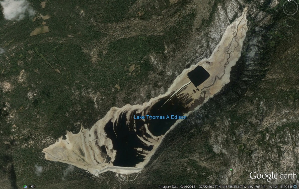 Don't think it can get much lower. The imagery date on that screenshot was only a month after your photo.
|
|
|
Re: Snowpack
|
Joined: Sep 2009
Posts: 8,533 Likes: 107
|
|
Joined: Sep 2009
Posts: 8,533 Likes: 107 |
Dave Alden: Thank you for labeling the picture! Lake Sabrina is the lake, not South Lake. I appreciate your work.  ...any chance you could find the time to label the fourteeners in the other picture? :-)
|
|
|
Re: Snowpack
|
Joined: Sep 2011
Posts: 1,158
|
|
Joined: Sep 2011
Posts: 1,158 |
I only brought this up to point out the ice variabiity from year to year. I agree no interest in posting various "proofs" for one side or the other. Climate change is real, but the "why" has become like religion. Maybe the "truth" is somewhere in the middle.
Even the Bush administration's science team, Exxon Mobil, and every other oil company has recognized the "why" of climate change associated with human activity. So they're also religious zealots? It's been interesting to watch as their story changed from "no it's not warming" to "okay, it's warming but it's not due to humans" to, "okay it's warming and humans are contributing" to today's PR message "okay it's warming, we need to stabilize our CO2 output, but it won't be that bad." The real question will be asked by future generations, "why did our generation knowingly take this risk and leave them paying the price?" And I'll stop there as well and get back to the snowpack topic, which most climate change models predict to decrease in California as a trend toward more rain and less as snowpack. What we have right now is just a good old fashion drought.
|
|
|
Re: Snowpack
|
Joined: Sep 2011
Posts: 1,158
|
|
Joined: Sep 2011
Posts: 1,158 |
|
|
|
Re: Snowpack
|
Joined: Sep 2011
Posts: 1,158
|
|
Joined: Sep 2011
Posts: 1,158 |
Don't think it can get much lower.
The imagery date on that screenshot was only a month after your photo. So Cal Edison generates as much hydropower as they can each year from water stored in Edison and Florence, and their entire Northern & Eastern Hydro Systems, so these lakes get pretty darn low every fall anyway. The drastic drawdown shown in the photos of this thread might be associated more with San Onofre nuclear plant being decommissioned than the drought.
|
|
|
Re: Snowpack
|
Joined: Sep 2009
Posts: 8,533 Likes: 107
|
|
Joined: Sep 2009
Posts: 8,533 Likes: 107 |
WZ member Paul sent me these two pictures from South Lake he took back in May, and a link to an Inyo Register article: Not enough water for local lakesSouth Lake Memorial Weekend 2013  The old earthen dam…… 
|
|
|
Re: Snowpack
|
Joined: Sep 2011
Posts: 1,158
|
|
Joined: Sep 2011
Posts: 1,158 |
I was there during the fish opener, end of April 2013. Hiked a mile or so above Sabrina and then above South Lake. Just realized the lakes were so ugly I didn't take any pictures. People were driving down the boat ramp onto the lake bottom out to the remaining "ponds" to fish.
The article you linked to is very detailed about all the various demands on the Bishop lakes and eastern system in general. Different set of constraints for the Eastern Hydro system than the Northern Hydro lakes at Edison and Florence where they tend to drain those lakes pretty low every year fall anyway. By the time the road opens up to that area in late spring, they're pretty full again. I'm not discounting the effect of the drought on Edison and Florence, just saying they have different demands on them and hydro is a higher priority there. Not sure if the shutdown at San Onofre nuclear plant is playing a role, but it might be. SoCal Edison is under enormous pressure right now with all this going on.
|
|
|
Re: Snowpack
|
Joined: Feb 2011
Posts: 1,572
|
|
OP
Joined: Feb 2011
Posts: 1,572 |
SN: Your initial observation is correct, but it contradicts your conclusion about SONGS:
So Cal Edison generates as much hydropower as they can each year from water stored in Edison and Florence, and their entire Northern & Eastern Hydro Systems, so these lakes get pretty darn low every fall anyway. The drastic drawdown shown in the photos of this thread might be associated more with San Onofre nuclear plant being decommissioned than the drought.
[Emphasis added] Since they generate as much as they can every year, they can't can't generate any more, whether SONGS is down or not. So the drastic drawdown can't be due to the SONGS outage, it can only be due to the normal production and the abnormal lack of replenishment.
Wherever you go, there you are. SPOTMe!
|
|
|
|
|