This report is for conditions on Thursday, July 21st.
Our group of four (including a 13 year old) summited on the 21st on a day permit via the MWMT. Two of us were on Diamox since Tuesday. BTW, three of the four in our group summited last year on July 8th... with me being the one who didn't summit. I got AMS last year and turned around with two switchbacks to go to Trail Crest.
We started at 3am via the Old Trail. We decided to do the Old Trail after a scouting hike Tuesday afternoon to Lone Pine Lake. Even though it's a few degrees steeper it's easy hiking, shaves about half a mile each way, and you reduce the chances of getting water in your boots down to ZERO as it comes out at the woodden sign just past the North Fork crossing of Lone Pine Creek. You run a good chance to get water in your boots in the dark with the current snowmelt. I took a photo of where the Old Trail starts with my other camera... will try to post it later.
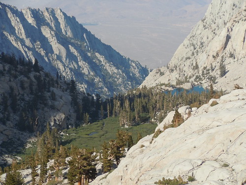
We entered the Whitney Zone at 4:30am. Water level at the logs crossing below Lone Pine Lake was not an issue. Same goes for the rock hopping around Outpost Camp. Use your poles for balance in case you slip on the wet rocks.
We saw the sun rise at 5:56am and the fabulous Alpenglow that comes with it on a clear day.

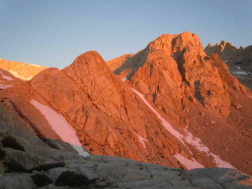
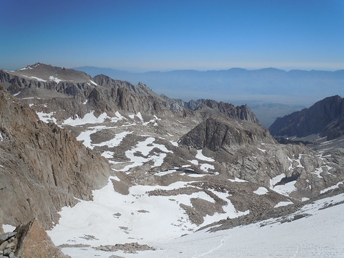
We made it to Trailside Meadow at 6:15am.
I recall at least three to four small snow fields above/around Trailside Meadow. Some longer, some shorter, but all are easily passable w/ poles for the average outdoors type folk. I'll qualify that by saying that I have very little snow-hiking experience and was born w/o the risk gene. I'm from Puerto Rico and left the island at age 22... didn't see snow fall until age 30... my comfort level around snow is still close to none at age 48. There is one field a little steeper and slushier than the others, but it's nothing to worry about with poles... if you happen to lose your footing there and slip you might bang up a knee or your behind, but most likely just your ego. I did not see any dead-end snow paths above Trailside Meadows (there were more than a few on my failed summit attempt on July 8th last year).
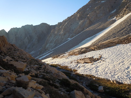
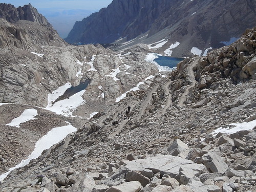
We made it to Trail Camp around 7:15am. A good amount of snow remains half around the lake, but there was no ice on the surface. Last year we had to break a thin layer of ice to filter water. We filtered water here. Each adult carried 1 gallon to the summit. There was only one more spot to get water after Trail Camp... there is a spring somewhere around switchback #20. Even carrying a gallon, I ran out of water halfway down the switchbacks on the return. Plan accordingly. We left Trail Camp at 7:40am.
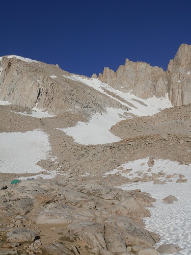
Now to the topic of highest interest... the cables and switchbacks. Up the switchbacks there were 2-3 corners where I had to scramble up the rocks because of snow. I'm somewhat uncoordinated so I took off my poles and went hand over hand. It was easy going. I made it to the cables at 8:35am. The cables are almost 100% free of snow. I cannot convey how happy I was to see this after my terrifying crossing last year on a ledge of 6-12" or rock while suffering AMS. As you approach the cables, there is snow covering the switchback so you'll have to scramble up the rocks to get to the cables. On the last step you actually pull yourself up using the end of the cable. I took my poles off in both directions and went hand over hand w/o issues. Just be careful.
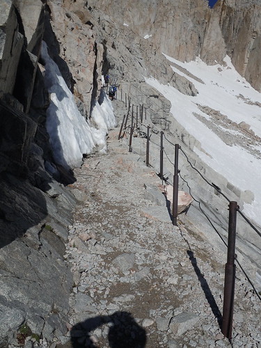
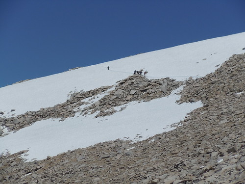
After the cables it's easy trekking until you get to the last of the switchbacks where there are two snow fields just below Trail Crest. The first was scary for me, but well trodden. I did it w/o my micro spikes on the way up, but put them on on the way down for a little re-assurance. I took the below photo after crossing it.
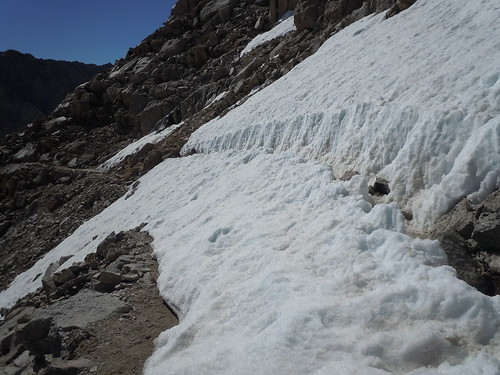
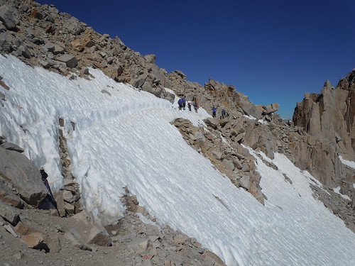
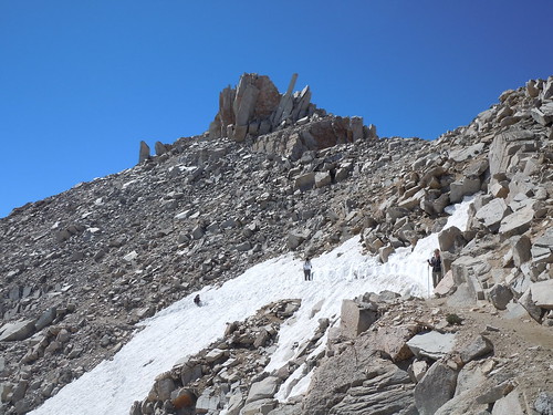
The snow field on the last switchback before Trail Crest was SCARY for me... I used my micro spikes and made it across w/o problems. I saw people crossing with NO poles. Photos below are from both ends. As you can see in the middle photo the last few feet are the worse as there is no trench to protect your steps. I'd strongly recommend you have two poles if you're not confident around snow. I held one short (mountain side) and used it to pull myself in towards the mountain and kept the other one long to keep against the drop. Do not look down... focus on your feet and the next step. Do not look up ahead... it will take however long it takes you to get across... some people took their time while others breezed through. I took my time in both directions!

I made it to Trail Crest at 10:10am and about 15 minutes ahead of the rest of my group. BTW, we didn't see anyone coming up the chute... everyone was travelling through the switchbacks.


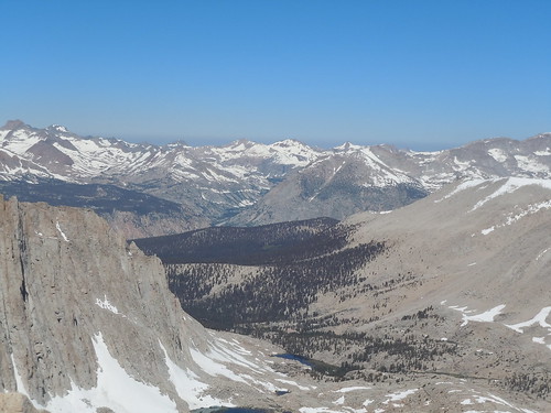
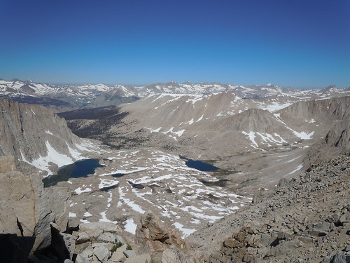
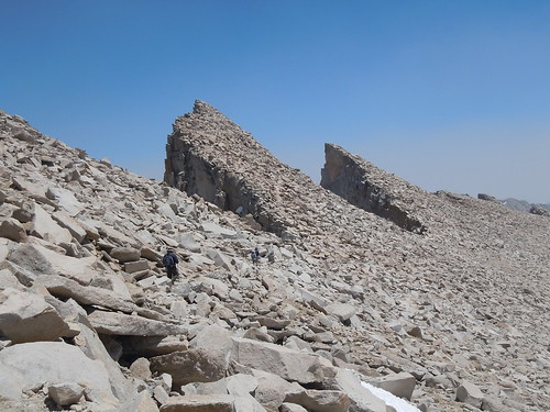
The strong winds from earlier in the week had died down by Thursday, still it was cold enough to wear my wind/rain jacket past Trail Crest. From there on we were treated with amazing (and sometimes intimidating) views all the way to the summit. I found two to three uncomfortable spots on the west ridge... the first window and two spots where rock falls made the trail footing only a foot wide... again, I held on to the rocks over those two crossings. Having done the two snow fields at Trail Crest I'll say the snow field on the west face below the summit was significantly longer, but much less worrysome. Watch out for the rocks half way up and for post holing. I used the microspikes on the way down.

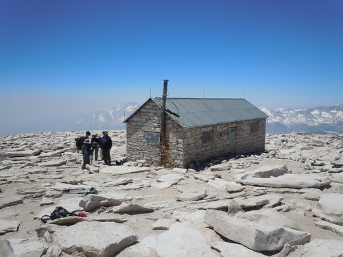
I summited at 12:30pm after 9:30 hours total hiking plus stop time. The last 200ft gain felt endless. There were at least 15-20 other people at the summit. Some people's phones were working so I got to make a call to my wife from the summit. My thanks again to the guy who lent me his cell phone... much appreciated! I found the summit surprisingly flat.
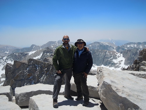
We had lunch at the summit and hung around for about thirty minutes and started our descent at 1:00pm. At 2:15-2:30pm there were still people coming up the ridge towards the summit. The descent is a little rough on the knees, especially between Trail Camp down to Mirror Lake. We were off the trail at 7:20pm... so about a 6:20 hour descent including stop time.

If interested, you can see the complete Flickr photo set at,
http://www.flickr.com/photos/doncoqui/sets/72157627270039954/with/5970024303/ (the first 30 or so photos are pre-hike photos meant for family and friends).
Lessons learned & confirmed,
- drink, drink, drink... eat, eat, eat.
- turn around if you get AMS symptoms. The mountain is not going anywhere anytime soon. We saw more than a few people who got AMS and were either stopped or had turned around.
- take no less than 3 liters up the switchbacks. You'll need that and maybe more.
- bring two poles and micro spikes if you have them and need reassurance.
- bring a thin jacket to keep the wind out.
- maintain your focus on the way down.
All in all it was a tremendous experience. Thanks to all those who posted TRs and photos of current conditions in the last few weeks. Your posts were essential in preparing for the hike!
Regards & good luck,
Luis