My Sierra trip for this year was already planned when I got an email from some friends with an invitation to hike up some Colorado fourteeners. There were only a few days between these two adventures so the logistics seemed obvious: road trip! Even some car trouble along the way couldn't take away from all of the fun.
On August 31, I met up with my Sierra hiking buddy at the Dow Villa Hotel. He had just driven in from the Bay Area and I came from Oklahoma. To start acclimatizing, we went to Whitney Portal and hiked up the old Mount Whitney trail to where it meets the main trail. I hadn't been on the old trail before but I've read about it here and now I'm glad to know about it - it's a very nice hike. We had hamburgers for dinner at the Portal Store and went back to Lone Pine. The next morning we drove to Horseshoe Meadow and hiked to the top of Trail Peak, something I'd also read about here in posts by Steve C and others. We found it to be a great acclimatization hike.
The next morning, our seven days in the backcountry began at the Shepherd Pass trailhead. This was my third time on this trail and it's becoming one of my favorites. It's uncrowded and I like that it climbs right up out of the desert and on up into the high alpine environment. The downside, of course, is you have to gain a lot of elevation. With an early start we were able to make good time to Anvil Camp where we wondered how the camp got its name.
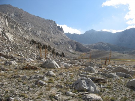
On Day 2 we continued over Shepherd Pass and after a leisurely lunch stop in a meadow on the other side, we left the trail and went south over Rockwell Pass (saddle on the ridge just northeast of Tawny Point) into the Wright Lakes Basin. Our destination was the uppermost lake in the basin but we got delayed by trying to stay too high contouring around from the pass. In the afternoon we found ourselves at a very nice lake lower down in the basin and decided to camp there for the night. By the way, our small contouring issue aside, off trail navigation and hiking in this area - from the Wright Creek drainage to the Wallace Creek drainage on up to Tulainyo Lake - is mostly straight forward and not technical. It's a great place to visit if you like to get away from the beaten path.
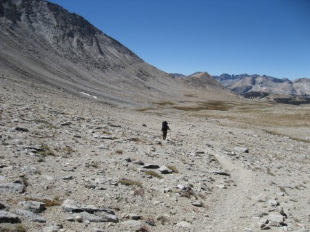
Going down the southwest side of Shepherd Pass. Rockwell Pass is the low point on the ridge just ahead.
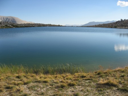
View to the south from our camp in the lower part of Wright Lakes Basin.
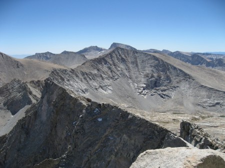
Day 3 was a short hike up to our high camp at the outlet end of Lake 11,959', aka Versteeg Lake. We spent extra time securing the tents from the above-treeline wind so we wouldn't worry about being away on day hikes the next couple of days. This lake is in an awesome High Sierra alpine setting with big walls and high peaks surrounding the rock landscape. From our campsite we could see the pointed summit of Mount Tyndall, our scrambling goal for the next morning.
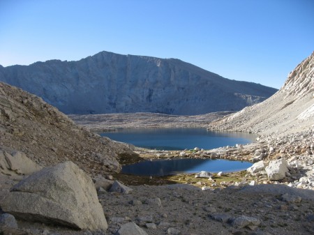
Lake 11,959', aka Versteeg Lake. Camp is on the far side of the lake. The summit of Mount Barnard is on the skyline left of center.
Day 4 we were up at dawn and on our way around the lake to where we headed up the southwest slope of Mount Tyndall. On the lower 1/3 or so of the slope we negotiated a series of chutes with loose scree. The upper part was easier, more stable climbing. On the summit we paused for pictures and to take in the incredible views of the Sierra Crest, the Great Western Divide, Owens Valley, and Mount Whitney. We took extra care on the way down to get through the lower 1/3 as the scree seemed particularly loose on decent.
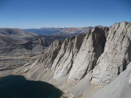
The view from part way up the southwest slope of Mount Tyndall.
The highlight of this trip was to climb Mount Tyndall in the 150th anniversary year of the first ascent, which itself was intended to be a first ascent of Mount Whitney. My understanding of the story is on July 2, 1864, the Brewer Party of the California Geological Survey, surveying from the top of Mount Brewer, were the first to identify Mount Whitney as the highest peak in the United States. A couple of days later two members of that party, Clarence King and Richard Cotter, set off cross country to be the first to climb it. But close up it was difficult to see which peak was the tallest and they ended up on the summit of Mount Tyndall. They were running low on supplies so they had to get back to rejoin the rest of their party, leaving Mount Whitney for another time. The southwest slope route that we took up and back was their decent route.
This is the view of Mount Whitney (skyline, center) that greeted King and Cotter when they reached the summit of Mount Tyndall 150 years ago.
On Day 5 we had planned to climb Mount Barnard but the northern flank of the ridge to attain the peak's southwest slope didn't look inviting to us. Rather than go all the way down to the Wallace Creek drainage to access the southwest slope directly, we opted to hike around and explore the Wright Lakes area instead.
We broke camp and headed out from there on Day 6, our first day with any significant clouds in the sky.
On the way out, looking back up the basin toward Lake 11,959'. Much of the cross country travel in this area is on easy terrain like this.
It rained some through the night at Anvil Camp, but early on Day 7 there was enough of a break in the weather to pack up and get on our way back to the trailhead. There were a few periods of rain as we hiked out which served to kept things cool. Particularly lower down, the forest becomes more fragrant right after the rain.
Three miles from the trailhead, where the trail crosses the ridge between Shepherd Creek and Symmes Creek.
Things unraveled somewhat that afternoon on the drive out from the trailhead. It seems I misjudged a rock on the dirt road, seriously damaging the transmission in my car and rendering it unable to shift out of drive. We didn't see any fluid leaking, so we continued on to Lone Pine. I spent the evening on the phone figuring out what to do, of course with time out for a shower and then a Chile Verde dinner at the Bonanza.
Thanks to AAA and MS Transport in Independence I had a very enjoyable ride through Death Valley to Las Vegas in their new Kenworth flatbed truck. The folks at Desert Oasis European Auto Service and Repair in Las Vegas were sympathetic to my situation and jumped into action right away. Within an hour of when I arrived, my car was up on the lift, diagnosed, and parts were on the way. They had me back on the road the next day and overall I was only delayed by 24 hours.
From there, I drove to Colorado and joined the group for several days of fourteeners day hiking. We climbed Evans (from the closed gate at Summit Lake), Grays, Torreys, Sherman, Elbert, and Belford. I would usually tend to think this was a little late in the season for the Colorado fourteeners, but we were treated to good weather and some very spectacular fall colors.


