The
new map shows an incredible number of gps routes covered, by ground and by helicopter!
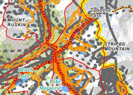
Here's just a part of the map. Gray lines are helicopter gps lines, orange are ground search tracks.
Today's news release:
Sequoia and Kings Canyon National Parks News Release
October 31, 2012
Contact: Dana M. Dierkes
Phone: (559) 565-3131 (office) and (559) 679-2866 (cell)
Aerial Search Continued Today for Missing Hiker Larry Conn at Kings Canyon National Park
Sequoia and Kings Canyon National Parks, CA – An aerial search continued for missing hiker Larry Conn at Kings Canyon National Park on Wednesday, October 31, 2012. The search focused on specific high-probability areas, including likely travel corridors/camp locations around Pinchot Pass, Taboose Pass, and Split Mountain. Despite aggressive searching, no clues have been tied to Larry Conn since he was seen by another hiker near his vehicle on October 19. The search will be temporarily suspended on Thursday, November 1, due to impending weather conditions. Managers continue to evaluate any new information to determine the direction of search efforts over the coming days.


