Ok, now for pictures...
View of the lower switchbacks from Trail Camp. Many of the lower ones are buried under snow. I walked a zig-zag line up to the first ones left of the main tracks thru the snow. (click on each picture to see the full-size view.)

Switchback trail thru the cables section.

The bend at the top of the cables. It is a steady incline, even though the picture doesn't look that way.

Looking back down the cables section.

Mid-way traverse, looking eastward, Consultation Lk below. You can see my tracks where I walked the switchbacks below, then climbed up, looking for the next sign of the trail. Not finding it, I checked the EarthMate map on my iPhone, and realized it crossed this big snow field heading up and west.

The same midway traverse, looking west.

The top switchback traverse. Spot my hiking poles


The top switchback traverse. (to the right of the picture above).

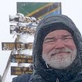
I finished digging out the traverse above, and reached Trail Crest at 4 pm. The traverse should have been made a little wider, but time was ticking away, and I needed to get down! The traverse is just a few feet up that incline to the right of the sign.

Here's my view of the Whitney summit and the hut (red arrow). That is Mt Muir on the left. This is as close as I got to the summit this year.

All my pictures from the trip
are here with captions.