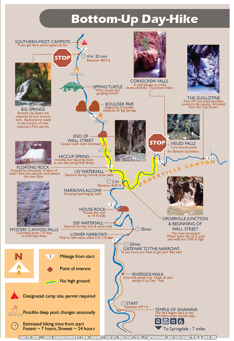
Some questions: How well did your GPS work in the slot like that? I am surprised you got a decent track.
It worked ok, but the signal bounced around a lot. I cleaned up the track using GPSVisualizer, deleting the trackpoints that were way off.
I carried it out of curiousity primarily and was surprised how much it actually tracked.
How cold was the water -- did you really need the waders?
The water was about 55 degrees. About half of the people we saw did not use waders. On our way out, we probably saw about 10 people that were wearing full suits.
Can you identify the picture you took farthest up stream? When we did the hike, there was definitely one place where the water was chest deep in the middle, and some found a ledge to walk along the side that was thigh deep. Some of your pics show pools similar to what we had to go through.
This may have been the pool that turned us around:
http://hikinggeek.com/wp-content/plugins...ws/DSC05018.JPGI am basing this on timestamps and my memory.
I believe we turned around at the "4" on this map:

We met a couple hiking down as we were hiking up. They said they talk to hikers that had done the top-down hike before the big dump of rain and there were two sections where they needed to swim for about 20 feet.
Another comment: I would definitely recommend two hiking poles over a single one. They really help balance when you can't see the rocky bottom.
I agree. There were times when I lifted one foot off of the ground and thought I was gonna go for a dunk!