I am hoping to get to Tehipite Valley later this summer. Could anyone with any information please post it. I am interested in trailhead, pictures, trail conditions, and Valley conditions please. Also, if want to give me a clue where I can spot the rockwall drawings by native Americans, that would be greatly appreciated. Thank you in advance.
Right now I am looking at the Rancheria Trailhead to enter. That is located below Wishon Reservoir. But, that is one of the questions I have. Is that a good starting point?
Lambertina, if you are out there, I know you have made this hike. Any info and pictures would be greatrly appreciated.
Well I think that is going to be the shortest and easiest way to get there. I was planning to do a loop over Granite Pass from Roads End then back to Cedar Grove over Kennedy Pass. I'm sure this route will be far more scenic but MUCH more difficult!
I've not hiked in that area before, but I keep eyeing that Tehipite Valley, and wondering how inaccessible it is via the Hwy 180 in Kings Canyon. One of these years, I am going to try going upstream through that canyon in the fall when the water is low. It looks like 6 - 10 miles of off-trail travel.
If that worked, the next year, I'd set up a trans-sierra from Bishop Pass all the way down to that same point.
By the way, looking at maps, I see the Crown Valley area has a group of buildings. Must be (or have been at some point) a 4wd road into there. I've sent an email to lambertiana--maybe he'll post here.
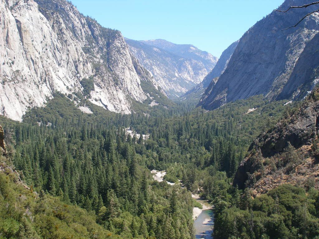
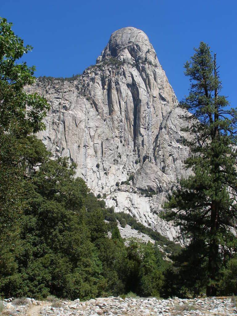
I found lambertiana's album on photobucket here. Here are two of his pictures:
Funny Steve, I was looking at the map and thinking the same thing.
I've never been there, although I have been to Crown Lake, clearing trail. We are talking remote and desolate. The day I went to Crown Lake, I was by myself, and I did not see a single person the entire day. ( I was camped at Chimney Lake, a lovely place)
This is by Ron Hudson, a very serious-level mountaineer. If you don't think so, when he left from this trip, read further, when he left to go to Tahoe, and win the US Orienteering Championships in his age group and bag 5 peaks, then come back down and bag Tehipite by the traditional Rancheria route as a 29 mile DAYHIKE.
They did it as a 8 mile hike from Yucca Flat, right up to Tehipite Valley, along the River. Hudson took a little more than a day, the other a little less. Both upstream, and they both took loops over Granite Pass.
I did Roads End to Simpson Meadow and back over Granite in 26 hours or so once. I did Roads End to the JMT and then to Simpson and up out over Granite, but I got sick and had to bivy an hour from the pass. The climb out of Simpson sucked real bad both times, but the 1st time I ran out of water and the second time I was sick. The actual climb didn't seem that bad though. There's a peak I've wanted to do in that area for years with Da Moose, but we never could get our schedules to mesh. The whole area is incredible................................DUG
A friend of mine and I did some modest climbing in the Gorge of Despair over 50 years ago. It overlooks the Middle Fork and the Tehipite area. Very rugged, beautiful but isolated area.
I found this video posted on Youtube. It is a video taken from a helicopter flying over Tehipite Valley, with nice views of waterfalls and Tehipite Dome.
Caption on the video: Middle Fork of the Kings River there is a beautiful valley in the Sequoia National Park called Tehipite this a ride through it on a high water year.