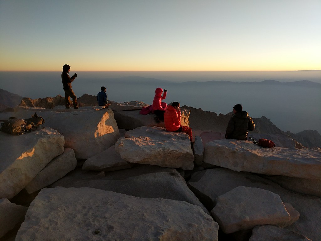
I awoke to my alarm on Sunday the 17th at 6:00, ensuring I’d make it up out of my bag to wander up to the edge and watch the sunrise. As I walked up the other two fellows who had slept on the summit were still fast asleep in their tents. Not long after though a few other intrepid hikers made their way up from several points to enjoy the sunrise from the top of Mt. Whitney. A woman from Long Beach had left Trail Camp at 2:00 to make it up there, and shortly after we were joined by a fellow whom had camped at Guitar Lake and was finishing his JMT through hike, and lastly an Englishman who was doing the PCT had hiked up from the JMT side as well joined our motley crew to watch the sun slowly slink from below the horizon and finally bathe the whole of the Sierra in its warm rays. While sitting around and chatting it turns out that the woman from Long Beach and the Englishman hiking the PCT had brought up way more water with them than they actually needed for the hike up to the summit. Being that it was going to be extra ballast on the way down that they didn't look forward to carrying, they had originally planned to dump it, but upon hearing that we were a bit short on water offered up their excess to us. This worked out well, as the remained of the liter I had from the night before that I had supplemented with snow melt was now frozen solid since I had neglected to stow it inside my bivy before tucking in for the evening the night before. The Englishman saw me applying my lip balm and asked if he could use some. He explained that he had lost his a few days prior and had a major case of chapped lips. Fortunately I had an extra tube of chapstick in my bear can, so as I went to my campsite to retrieve my water containers I grabbed the chap stick and gave it to the hiker in need. With the sun rising higher in the sky Jose and I said thanks to the generous hikers at the summit for the water and we proceeded back to our campsite to make coffee and breakfast and to begin packing up for our descent down the Mountaineers route.
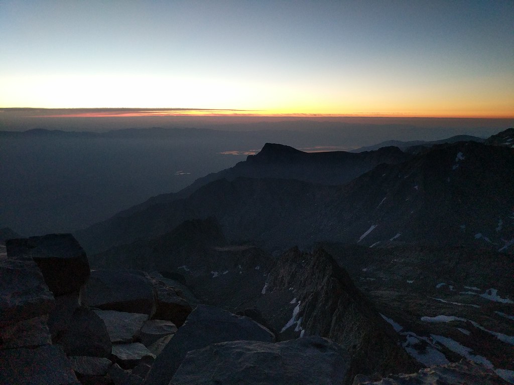
Sun just lighting up the horizon over Lone Pine Peak
Mt Russell in the early light.

Small group assembled to watch the sunrise
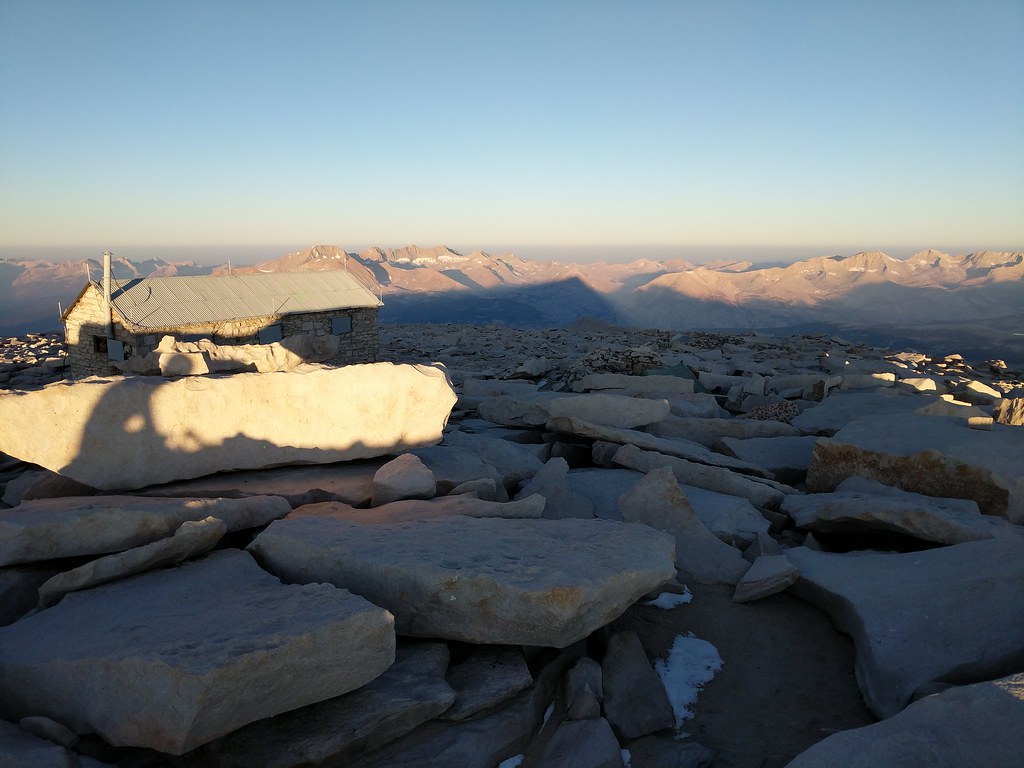
Whitney casting a long shadow to the west
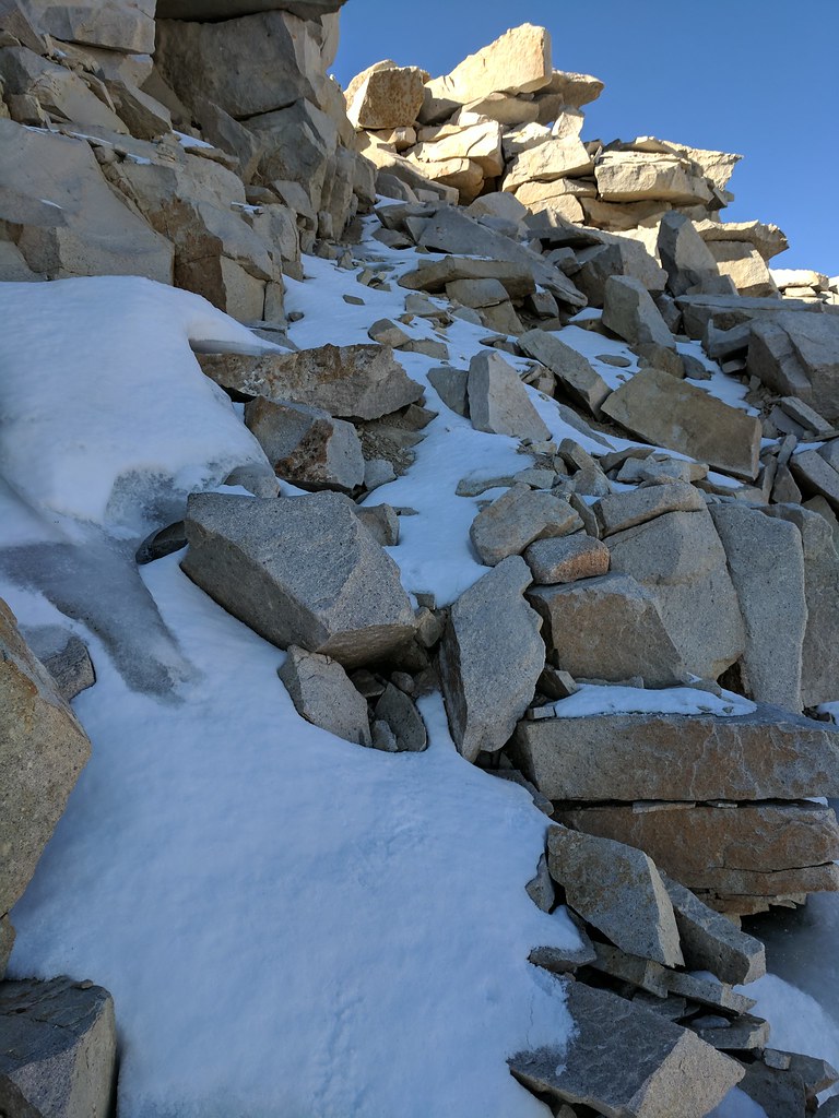
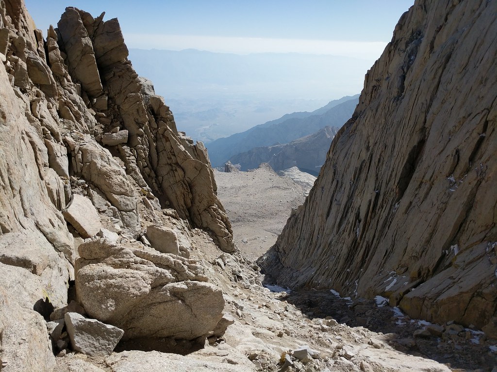
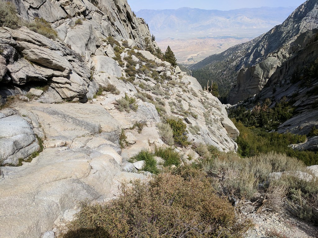
With everything packed up we began our way over towards the top of the final 400 around 9:00. We reached the edge and peered over and saw the route down to the notch. With full packs and neither of us having come up the final 400 before we decided to walk down the edge, looking for a duck that marked the entrance to the “easy walk off” which starts right about where the main trail bends away from the north edge and heads towards the summit proper. We found the duck right where it was supposed to be and took a peek at our proposed route. In a dryer year this route is normally just a class 2 scramble all the way to the notch. Well, this past year hasn't been a dry year so there were still patches of icy snow covered with a thin layer of fresh snow from a storm the previous weekend. Before descending we donned our helmets and microspikes as a little bit of extra traction would not be a bad thing. We started down in earnest, picking our way down slowly until we could see the normal class 2 route disappear into a snowfield that lay a bit further to the west. At the far end of this snow field on top of the ridge we saw the two fellows that had bivied on the summit with us the night before taking a look at the route from their point of view and probably trying to figure out their options at that point. Jose and I continued on, making our way down to the normal class 2 route and slowly picking our way towards the notch. Right before the notch there was a decent sized patch of high angle snow which appeared to start right about the same area of the class 3 route up the final 400. At the top the patch was pretty wide, but steep enough that we didn't feel confident in crossing that far with only microspikes and a trekking pole. So we dropped down a bit and had a go crossing at a spot that was quite a bit shorter. Jose felt a bit uneasy about it and wanted to continue down almost to the very bottom of the snow patch where it was at it’s narrowest. I figured I’d try and see if I could kick some steps across the section where I was at, which at that point was about 12’ wide in total. I had kicked about three steps in, and at the point where I was starting on the fourth I felt the exposure was a bit too much and retreated back from where I had started. What I wouldn't have given for an ice axe at that moment as It would have made cutting steps across trivial. Alas, I didn't have one so I followed Jose’s lead down and we crossed the snow patch at its smallest which was about 3 steps across, with a rock in the center to give a little more purchase. Although technically easier, this lower spot was quite exposed, with little there below to stop yourself if you were to happen to slip. Slowly Jose and I both made it across. There was a lot of small rocks and scree that had the probability of coming loose so I waited for Jose to make it completely across and climb up to the notch before I began. A short time later we were both standing atop the notch, ready to begin our descent of the Mountaineers Route in earnest.
First bit we came down from the duck
About midway across

Snowpatch before the notch
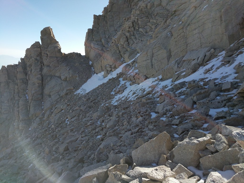
And across the snow patch, looking to where we started
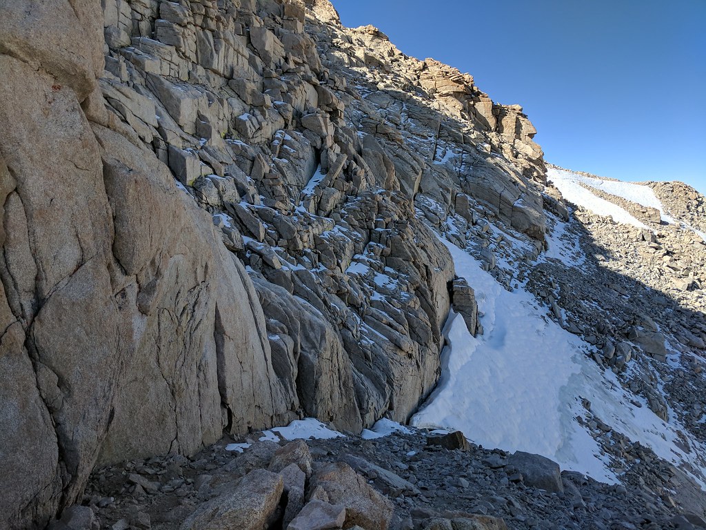
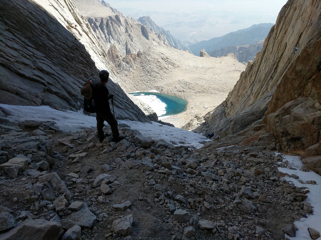
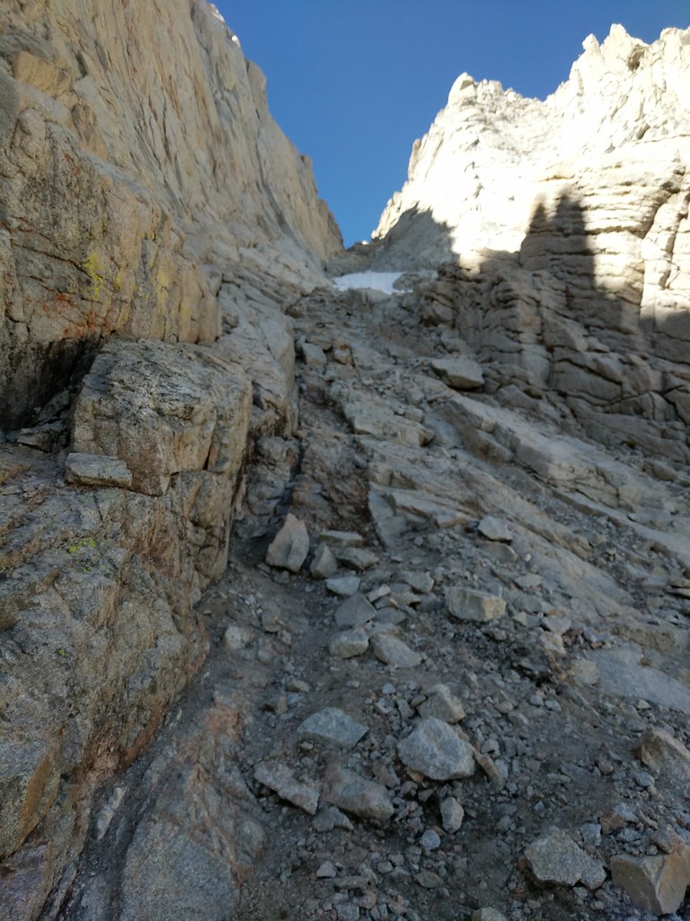
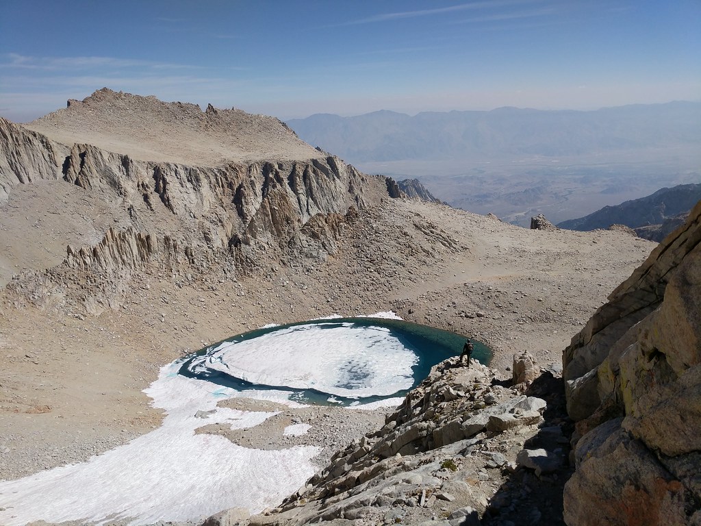
The first part of the MR goes pretty easily. It's steep, but the route is well used so route finding is pretty straight forward. We made good time until we were just above the middle, where there was still a portion of icy snow in the middle of the route. Below us there were two groups coming up - one group of 4 younger guys and second group of a older fellow and a woman. We decided to hang out at the top of the icy patch and let both groups come up, as it was way too easy to accidentally kick a rock loose and send it careening down onto those below us. All in all it took about 30 minutes for both groups to pass us and the route below to be clear. Again we donned our microspikes and slowly made our way down the 100’ section of icy snow with no drama. Once past the icy section we decided to stay to our right and take the approach for the east buttress climbing route which was dry and clear of snow versus the main chute which was still full of snow. The route down through here was definitely a lot steeper than the upper part of the Mountaineers Route that we had just traversed, but we took our time going down and in no time we found ourselves clear of the route and on the shores of Iceberg Lake just a little past noon. At Iceberg Lake we stopped for a bite to eat and to fill up on water for the hike down the rest of the North Fork of Lone Pine Creek Route to our final destination of the day, Whitney Portal. We began our descent, following the use trails down from Iceberg Lake, past the bowl in which Upper Boy Scout Lake sits in, down the slabs and through the edge of Clyde Meadow, along the east side of Lower Boy Scout Lake, descending the Ebersbacher Ledges, making a few crossings of the creek and finally joining the main trail. It’s always funny when you’ve been out for a few days off the beaten path and then suddenly you are in a super popular area and there are a ton of day hikers. The smell of fabric softener and looking how peppy and clean everyone is. Always good for a giggle or two. We made very quick time now that we were on the final stretch of our journey on a superhighway of a trail. We arrived at the end of our journey, Whitney Portal, at 4:10 pm, just a little over 7 hours from when we had started that morning. We used the facilities, picked up a drink from the Portal Store, and then proceeded to hop into Jose’s truck and make the drive from the Portal back up to Horseshoe Meadows to pick up my Truck. Along the way to Horseshoe Meadows we both commented on how neither of us looked forward to ever going up the North Fork of Lone Pine Creek route anytime in the future. Yeah, not any time soon..
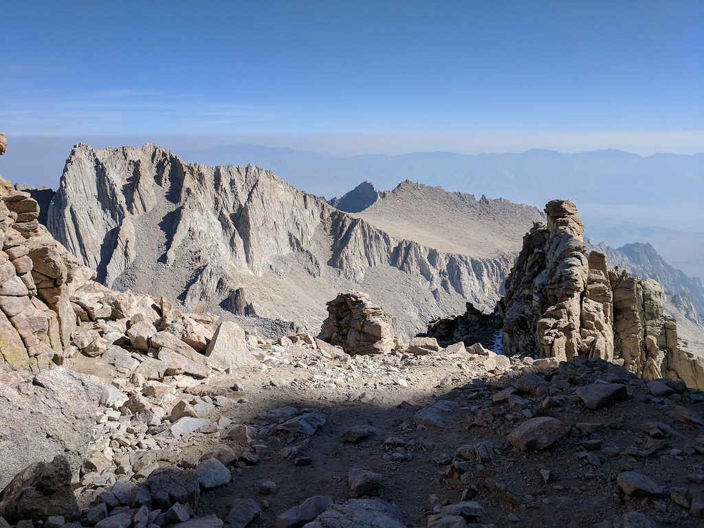
Russell and Carillon from the top of the notch
Looking down the MR
Jose waiting above the icy snowpatch for others to clear that section
Facing back up to the icy snowpatch
Jose surveying Iceberg Lake and Mt Carillon
At Iceberg Lake checking out what we had come down.
Iceberg Lake with a skin of ice on the surface
Wispy Clouds over Mt Whitney
Clyde Meadow
Lower Boyscout Lake
Start of the Ebersbacher Ledges
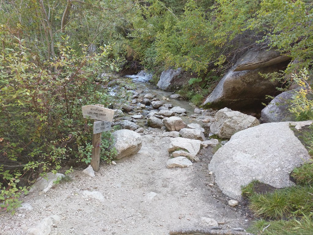
Beginning of the North Fork Route off of the Main Whitney Trail
So my take aways from this trip. Love going through Cottonwood Lakes. Always a great place to be, even if just passing through. Have to get back to the Miter Basin and spend some time fishing, exploring the other lakes tucked away up in the corners and tagging a few of the peaks in the area. The “Dreaded Sand Hill” Lives up to its name. When I finally make it up that way again I’ll definitely do it in the reverse order, coming down the sand hIll from Discovery Pinnacle. Sleeping overnight on the summit of Mount Whitney and and watching the sunrise was magical. If you don't have attitude issues and the weather is in your favor while you are up there then try it. If there’s any chance of weather though - don't risk it. They put those lighting warning signs up there on the approach and on the top for a reason. All in all, we had a great trip and saw some areas that we both had wanted to see for a while. This was Jose’s second summit of Mt. Whitney and my first. The main trail with all the red tape and all the people doesn't sound like the type of hike I like to take so I don't think I’ll ever head up that way. I’ve got that traverse from Shepherds to Horseshoe Meadows with some peaks in between to tag still on my list so I’ll be back - but it will again be via another scenic route.
Caltopo link to map with planned vs actual routes:
https://caltopo.com/m/JT82Full image gallery of my pics from this trip on Flickr:
https://flic.kr/s/aHsm852XS5 - There are a few 360° panoramas / photospheres that I shot as well that I couldn't get to embed right in my report.
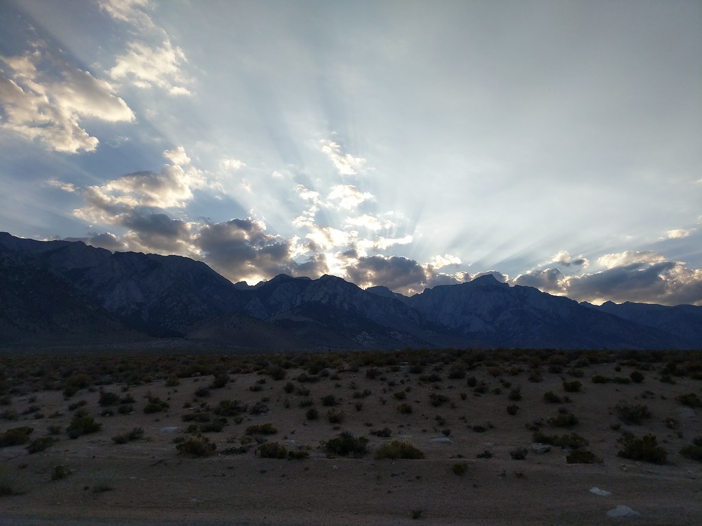
Sunset on the way home by the turn off for Lubken Canyon Road