JP, crampons and ice axe are a very good idea.
Weather coming this week is for snow between Tuesday and Wednesday night, and a possible accumulation of a foot of snow. It will be interesting to read reports later in the week.
I like the NOAA weather page for the
Mt Whitney summit (Link on the
Mt Whitney Weather page, too). Also on the Whitney Weather page is Howard Sheckter's
Mammoth Lakes Weather. Howard's text includes this:
The storm is a very significant one from a precipitation perspective, for so late in the season. Although I want to see some more model runs today and tonight, the thinking with most models is that there up to a good solid inch of QPF in it over a 48 hours period for the South Central Sierra. . The storm will become very convective and so there will be
some areas over the sierra, between Mammoth and Mt Whitney that may get up to a foot of snow, over the ridges. Once again this will depend upon the exact track and how it swings inland across Central and South Central CA. - See more at:
http://mammothweather.com/#sthash.eHPTwzyY.dpufJP, from 2012 conditions,
here are 3 pictures showing the cables section, a few switchbacks, and the chute to the west of the switchbacks (on the climber's right).
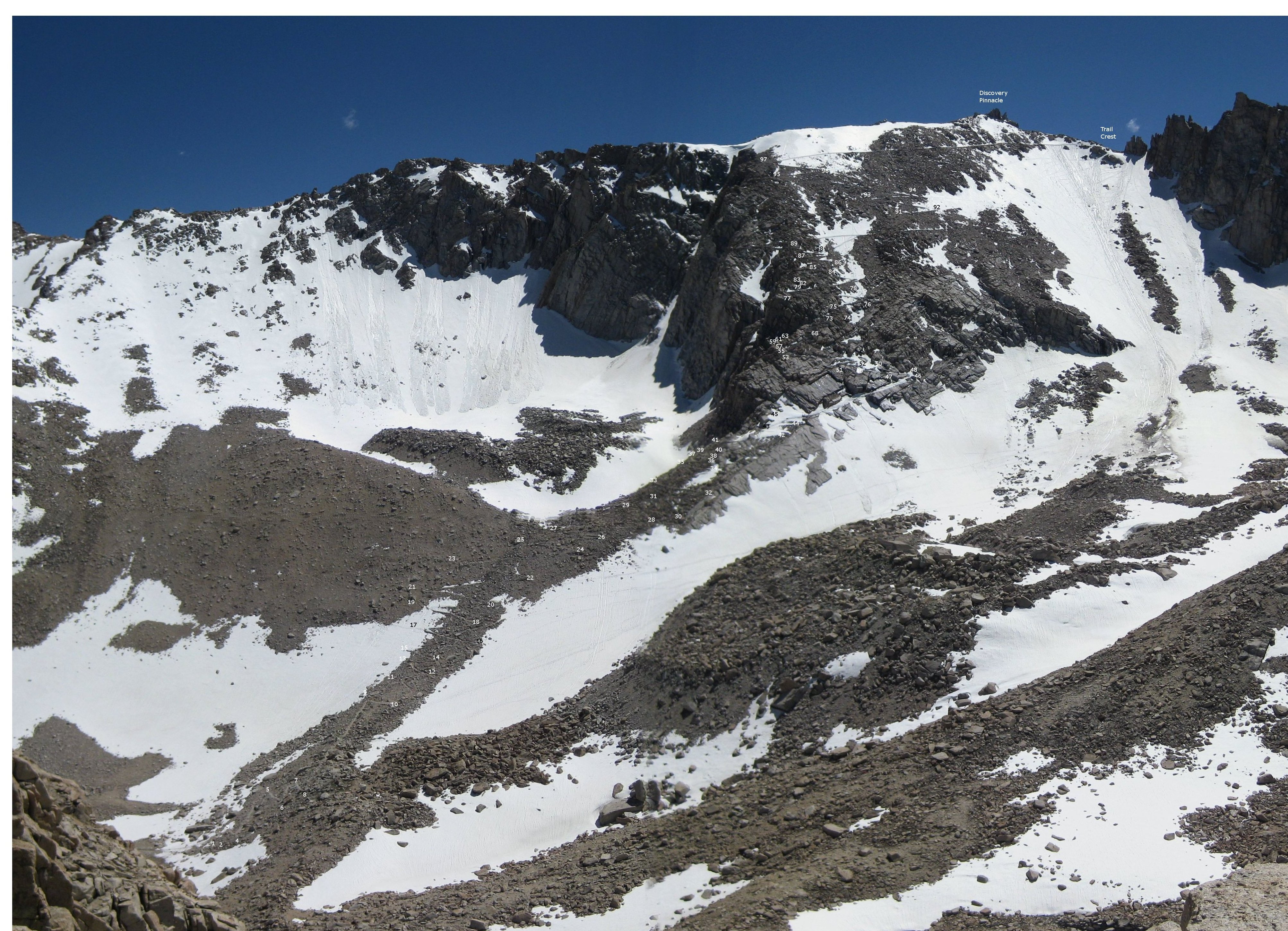
And for THE picture showing the switchbacks and the chute, BobR took this from Wotans Throne, and (the late) Wayne Pyle edited it and added the switchback numbers to the picture. You should be able to click on it, and zoom in and scroll around for the detail.
This is Wayne Pyle's switchback chart