Do you have any pictures of the drainage you took from Lower Soldier Lake to get to Sky Blue Lake? I'll be heading up that way on my way to Whitney in a about a week.
There are several different drainages.
First, you climb a drainage to get from Lower Soldier Lake to a ridge, and then you hang a right and angle down to Rock Creek. You can either follow the drainage on the northwest side LSL up to a ridge, contour around the ridge, and as you approach the Major General, start heading down a drainage to Rock Creek (the first part of this is the yellow in the picture below). Or, folks told me that, from LSL, you can climb a drainage on the northeast side of the lake up to the Major General (the pink in the picture below; do this correctly, and you will see a tarn at the top of the ridge), and then drop down a drainage to Rock Creek. We did the former. The latter is more direct but the drainage you climb up may be more difficult. This was tough going (for me) with a backpack. (Note: the yellow and pink lines are VERY approximate as I drew them freehand, please don't rely on them!!! They just are intended to give you an idea...).
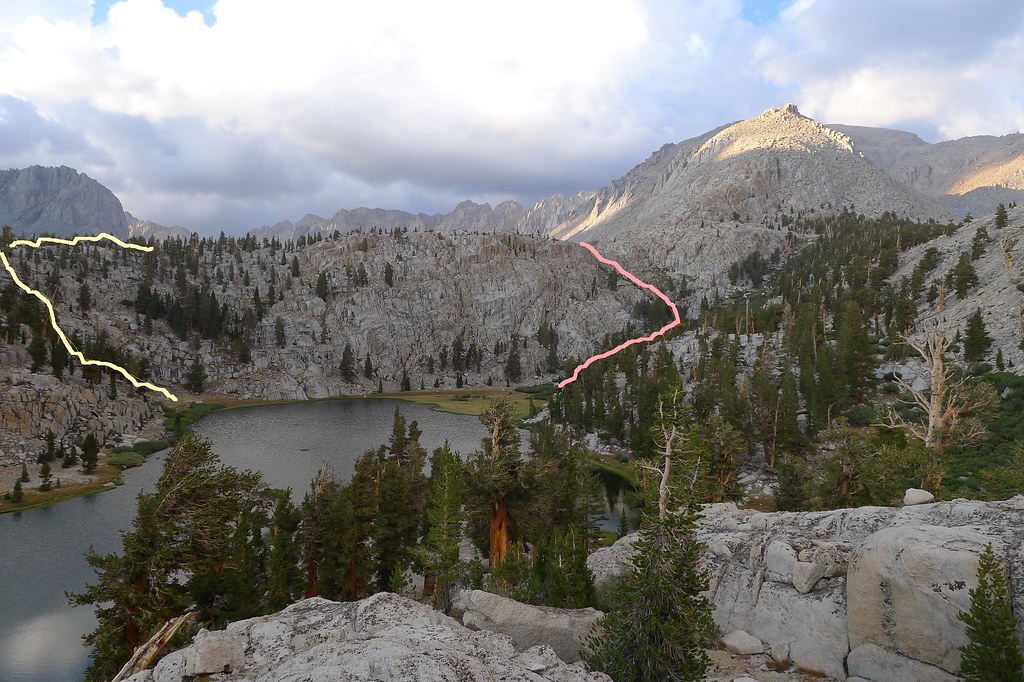
Second, you follow Rock Creek, which ultimately leads you to a vast open space with the Miter right in front of you. That's what you see in these pictures. In the first picture, we are descending to Rock Creek. We did so too quickly, and hit a class 3 scramble to get down. Better to stay closer to the rige until you are close to the Major General, then angle down the easy drainage there.
Descending to Rock Creek (we descended too soon...should have stayed higher longer)
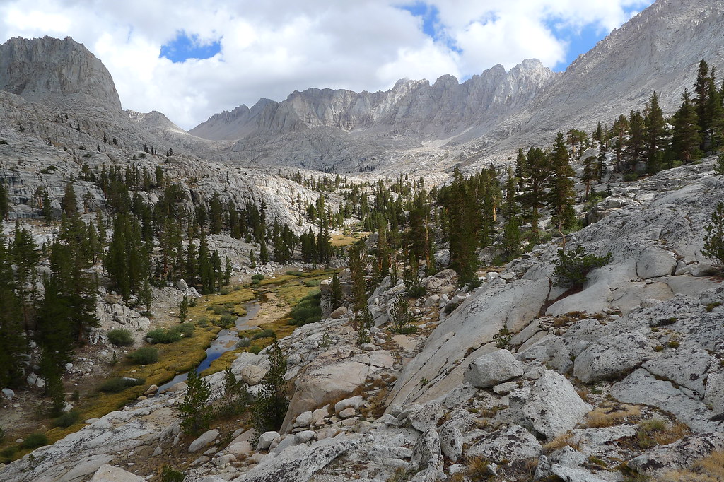
Approaching the Miter.

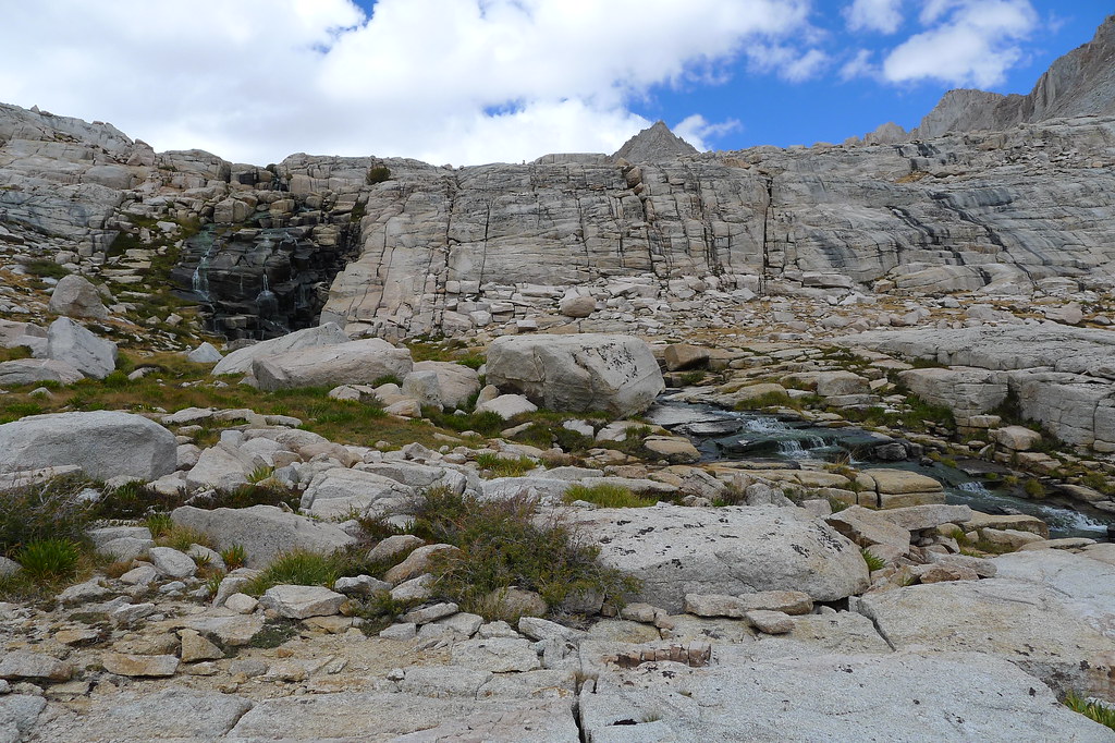
Skyblue Lake is just above the saddle to the left (west) of The Miter in the picture above. You follow a creek to get there. Right before the lake, you hit granite ledges, and either go left (west) of drainage (class 2) or right (east) (class 3), depending how gung-ho you are.
Hereis a picture of the granite ledges. We followed the greenery toward the left going up. I won't even try to explain what we did going down. We did not have packs for this portion since we camped near the base of the Miter.
So that's what we did. We had fun, and we thought it was suitable for our skill level (this was my first backpacking trip to incorporate cross-country travel). But, as you know, different folks evaluate these issues differently. Which is to say, caveat emptor, use at your own risk, not responsible for errors, yada yada, make good decisions, have a great time, and be safe.


