Your pictures of the hike profile and those from Google Earth are great. Including them here along with your captions for people to see:
So my Garmin GPS only has a 12 hour battery life - it died about 400 vertical feet from the end. So it looks like I did about 1 more mile than is shown here, I'll say it was 21.5 miles. Trail Crest is the slight downhill at mile 8.25, and Keeler Needle is the upward spike at mile 11.5.
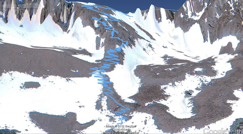
Google Earth view 1 - the trail is so long that you can't really see any detail above the Trail Camp, so I did separate shots for those sections.
These are the 97 switchbacks above Trail Camp leading to Trail Crest.
And finally, the view from the western side showing the path along the western side of the mountain. You can see my side trip up Keeler Needle, with a different path down as well. All in all, a trip with enough memories to last a lifetime, or until I go back next year!