I figure this deserves its own thread so that the information isn't lost in other threads and also so that other threads aren't cluttered with the information.
First, an overview of the old trail, google earth style:
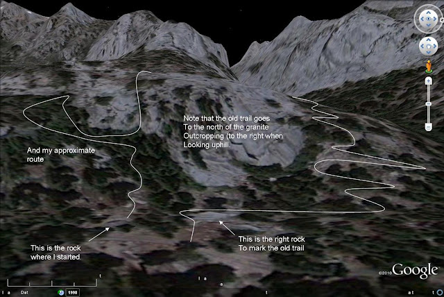
and then from actual ground level photos.


